
a collection of notes on areas of personal interest
- Introduction
- Arabic / Islamic design
- Arabic / Islamic geometry 01
- Arabic / Islamic geometry 02
- Arabic / Islamic geometry 03
- Arabic / Islamic geometry 04
- Islamic architecture
- Islamic urban design 01
- Islamic urban design 02
- Islamic urban design 03
- Islamic urban design 04
- Islamic urban design 05
- Arabic / Islamic gardens
- Gulf architecture 01
- Gulf architecture 02
- Gulf architecture 03
- Gulf architecture 04
- Gulf architecture 05
- Gulf architecture 06
- Gulf architecture 07
- Gulf architecture 08
- Infrastructure development
- The building industry
- Environmental control
- Perception
- The household on its lot
- A new approach – conceptual
- A new approach – principles
- A new approach – details
- al-Salata al jadida
- Public housing
- Expatriate housing study
- Apartment housing
- Pressures for change
- The State’s administration
- Society 01
- Society 02
- Society 03
- Society 04
- Society 05
- Society 06
- History of the peninsula
- Geography
- Planning 01
- Planning 02
- Population
- Traditional boats
- Boat types
- Old Qatar 01
- Old Qatar 02
- Security
- Protection
- Design brief
- Design elements
- Building regulations
- Glossary
- Glossary addendum
- References
- References addendum
- Links to other sites
The old buildings of Qatar
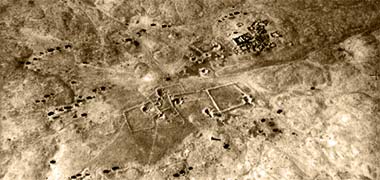
These two pages illustrate something of the older buildings and associated development in Qatar. They might usefully be read in association with the page looking at the history of the peninsula. A number of the photographs on this page are taken from the web site of the Qatar Embassy in Washington and are placed here under what I believe to be fair use, permission having been requested. There are also photographs from the web site of the Diwan al-Amiri in Qatar. In addition to these I have also been kindly directed to photographs on here and, from there found a link to this site, though you will find a certain amount of repetition on all these sites. These four sites have many more photographs than I have used here and I recommend them to those with an interest in the country. The first two photographs here, are likely to have been taken from the same image, captured in April 1937, and show an aerial view of the ruined fort at Helwan, situated to the south-east of Zubara.

Also included are photographs taken from a publication of the Qatar History Committee in 1977. My intention here is to show as wide a selection of old photographs as I can find in order to present a rounded picture of the immediate past of Qatar by the addition of what I hope will be an appropriate commentary. These photographs are a relatively limited resource at present, but I’m sure that, with time, more will become available and, if relevant, posted here. More probably, the State will make a concerted effort to obtain and record images from the past as part of its Museums programme.

Having said that, throughout these notes there are many of my own photographs scanned from 35mm Kodachrome transparencies I took mainly in the 1970s and 1980s, though they are not all individually dated. While they are usually not as old as the black and white and sepia images, they are sufficiently distant in time to record something of Qatar prior to its most recent developments.
This colour photograph, for instance, was taken in March 1975 at al-Zubara and shows what I recall as being the only part of a building of any significance still standing. In the background can be seen the military fort with its westerly extension to the right, later taken down. Regrettably I have no knowledge about the building and what its use might have been.
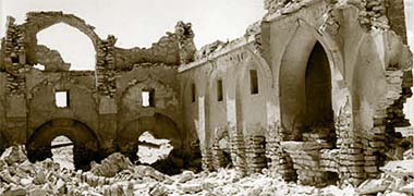

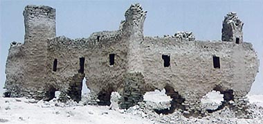

This next photograph is also of ruins at Zubara and is said to have been taken in 1960. I am not sure if it is the same building as that shown in the colour photograph above but feel it might be as it was the only building of that height at the time I took the photograph in 1975, and there are certainly similarities in the detailing of the arch on the right. I have come across no other photographs of structures in that area of anything approaching this height. As to what purpose the building had, I am unsure, but there is a suggestion in the two photographs which follow it – and are of the same building, but six years later on, taken in 1966 – that it is the remains of the house of a pearl merchant.
Whatever its function, the outside of the building illustrates a relatively defensive attitude in the small apertures some distance from the ground, though there do appear to be semi-circular openings at ground level – either doors or, more probably, windows – and located within an arched wall construction as can be seen in the upper photograph which illustrates its interior. The walls and arches are of masonry construction and, unusually are dressed in order to provide a degree of accuracy and structural coherence not attainable with the regular hasa construction of most of the traditional buildings in the peninsula. Note that the wall appears to show springing suggesting that there might have been a domed construction, or at least arches – it was difficult to see from the original photograph if the springers were developed laterally to support domes. The final image in this group seems to have been taken at an earlier time than the two images immediately above it as it shows the two arches still standing and seems to be coaeval with the first of this group of four images and has been taken from a similar viewpoint as that immediately above it.

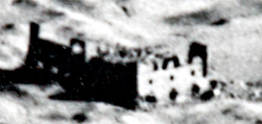
This aerial photograph is of the old development at Zubara. It is said to have been taken in the 1960s, but I have no other information that would give a more exact date. However, as we know that the two photographs immediately above were taken in 1966, this photograph must have been taken before then as it can be seen that there is more of the building standing in ruins at the lower centre of the photograph. A detail of it is shown below. The image is not of high quality as it was photographed directly from the original black and white aerial photograph.
Where possible I have put dates to the notes and photographs based on a number of considerations. Some of the photographs had dates associated with them, usually written on their backs, but I have discovered that they have not always been accurately ascribed. Because of this I have had to make assumptions. Please be aware of this in reading the notes. Should you have more accurate information I would be grateful if you would let me know so that I can correct or add information where appropriate.
Finally, I have found it difficult to make this and other pages logical essays; it will have to move backwards and forwards in time, location and type of building. My apologies for what follows…
Despite the foregoing, it is intended that these supporting notes will constitute a form of essay based solely on the photographs, hopefully tying them together in a manner that makes sense. There is a warning: I have corrected some previous mistakes I have made and I have corrected mistakes made by others, both in dating and in mirroring some photos as well as attributing incorrectly. It has been difficult dating some of the photographs and I may have made errors despite inspecting them as closely as possible. Because most images were small, this may have given rise to mistakes on my part. I hope not. I should also apologise for the uneven quality of the photographs. I have improved them where possible, but I have not attempted to create a similar look to each as, in doing so, I would have lost detail.
While the illustrations here are all photographs, there is some evidence from earlier days of how some of the urbanisations looked. In 1823 a ‘Trigonometric Plan of the Harbour of el-Biddah’ was published. It included not just a plan of the bay but also a sketch of the two towns of al-Bida and al-Doha. The sketch shows housing at al-Bida on each side of a square fort with circular corner towers situated near the sea. To its east there is a circular watch tower set back from the sea and, to its east, the housing of al-Doha around another square fort, this time having only two circular towers and one square tower. To its east there is another circular watch tower and, to the west of the fort there is a large building which appears to be a mosque. It may be significant that there are more boats pulled up on the foreshore at al-Doha than there are at al-Bida.
These first three aerial photographs – the first photograph above and these two below – are here because they are the earliest I have seen of any part of Qatar. The first of them is of a part of Zubara, the ancient development in the far north of the peninsula which was an important settlement for centuries, being the focus of interest for many of the families in this part of the Gulf. The photograph immediately below it was taken in 1960 and shows that there were some buildings still standing to first floor level. By the early 1970s these had all gone and there is little or nothing there now.

This aerial photograph is of Doha, taken from the south-west in 1937, and shows the settlement at that time to have been a relatively small urban development arranged round the wadi musheirib, leading to the sea and where boats were brought through the shallow waters to serve the town that had, by that time, become the most important settlement in the peninsula. Note how the development stretches east along the littoral to feriq al-Salata where Sheikh Abdulla’s original settlement had been made. The photograph clearly shows the three reefs off the old jetty and demonstrates that the jetty had not yet been constructed, the boats being pulled up close to or onto the land. The structure in the foreground is the old Turkish fort, known as the al-kuwt. The road to Rayyan leads out of the bottom towards the left hand corner of the photo and the wadi musheirib from the bottom right.

This first aerial photograph is likely to be one of the earliest photographs taken of urban settlement in Qatar. Its particular interest is that it shows the relationship between the two settlements of al-Bida and al-Doha sitting on the coastline. In the nineteenth and twentieth century the sea here was known as the Bay of Bida, suggesting the pre-eminence of the settlement at al-Bida. But by the time this photograph was taken it is obvious that Doha has become the larger urbanisation with development on the higher ground west of the wadi sail and, to a larger extent, on its east side, the wadi being the centre of what is now suq waqf, a common pattern for settlement development where roads follow the lines of water courses. Between al-Bida and al-Doha sits a fort approximately where the Diwan al-Amiri now stands. The likely reasons for there being more development to the east of the wadi sail than the west may be two-fold. Firstly it appears from the photograph that the coast is more suited to drawing up fishing and pearling craft than it is to the west and, secondly, that the Ruler of Qatar, Sheikh Abdullah bin Jassim, had developed his compound on feriq al-Salata, to the east of this photograph, illustrations of which can be seen further down the page.
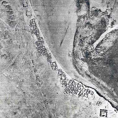
This second aerial photograph is taken from the same image as appears above, but was selected to concentrate on the development at al-Bida. Early images of al-Bida, made in the early years of the ninetieth century by a naval officer of the East India Company’s Bombay Marine, showed considerable fortifications to protect those living along this part of the coastline, and with al-Bida appearing to be more important than Doha. This characteristic was an inevitable consequence of development near the shores when the Gulf was awash with piracy based along its shores and on the Arabian Sea. However, by the middle of the twentieth century, this photograph having been taken post Second World War in 1947, the need for protection from attacks from either the sea or land had been diminished if not eliminated, though the building pattern would have reflected concerns pre-war.
The configuration of the urban development is interesting both for its spread along the littoral – reflecting the focus of the inhabitants of al-Bida in making their living from the sea – as well as for the apparent break in its centre, though I have no idea how this latter feature should have come about. Impossible to tell at this scale, it may be that there was a masjid located just north of its narrowest point. It is also noticeable that the buildings in the north half appear to be smaller than most of those nearer the fort. While there appear to be some transverse paths between the buildings to the shore, access along the development will have been mainly on the shore line. Note, too, the considerable extent of shallow waters in front of al-Bida, a feature which was still there in the 1970s and which was partly responsible for the decision to dredge the West Bay.


This next aerial photograph was said to have been taken in the late 1940s and from the south-east, showing more clearly the setting of Doha in its relationship with the West Bay. However, I believe it was taken on an aerial run in 1952 as close examination shows boats to be sitting or moored in similar positions to aerial photographs, taken in 1952, made from different angles.
The jetty at the end of the wadi Musheirib can be clearly seen with, at its northern end, the end extension that returned towards the east not yet constructed. More clearly, the three small reefs are identifiable as is the shallow land on the left of the photograph, east of al Markhiya, with the southern tip of jazeerat al Safliya just glimpsed in the top right hand corner of the photograph.
For comparison with both photographs, here is a photo of Doha taken in 1959. The photograph clearly illustrates how Doha and al-Bida were accessible by water, but with significant shallow waters to the west and reefs immediately opposite the centre of Doha’s suq.
The shallows were dredged in the nineteen seventies to create the New District of Doha, the reefs being used to form a base for extensions to the jetty developments as they were relatively hard and expensive to remove, as was another reef further out into the bay that was left and used as the base for the creation of an island that might form a focus within West Bay.
These two overhead aerial photographs of the centre of Doha may have been taken around the same time as the oblique above. The second is an enlargement of the centre of the first one. Close examination suggests they are similar. The road to Rayyan is evident, leading left and west; the road leading south may be the road leading to Wakra, though I believe there was also a track following the coast which would be out of picture, to the right. The site of the Diwan al-Amiri is clearly shown on the west side of the centre.
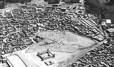
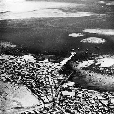
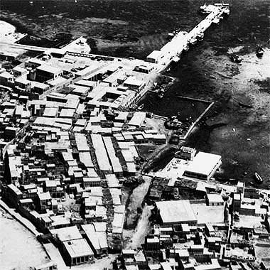

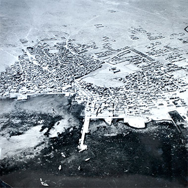
The next of this group of photos is a detail of that above. It is included in order to show more clearly the relationship between the suq, the maqbara, the al-kuwt and the open air prayer ground in the lower left corner of the photograph, as well as something of the texture of the residential and commercial development of Doha’s centre. It is a good illustration of a typical Arab town and its ad hoc expansion. Note that the maqbara is now the location of the car park associated with the redevelopment of suq waqf.
Here is another aerial view of centre of Doha, the photograph having been taken at a slightly different angle from that above. I am not sure of the date of the photograph, but the buildings look to be very similar, if not exactly the same as those above, suggesting that the photograph may have been taken at the same time, even on the same run. This photograph, particularly, illustrates how the littoral adjacent to the suq can be seen to be constrained – or protected by – the off-shore reefs.
Again this is a detail of the photograph above it and is placed here in order to get a better indication of the way in which the central suq was organised. The jetty which had been constructed against which the country craft could berth and unload their goods was a lineal construction. Some of the major merchants had their properties immediately to its west, or left in the photograph, and were able to bring goods straight into their warehouses adjacent to the shore. Near the shore the government had an area associated with Customs requirements, as well as a security facility.
Originally the suq was policed privately but, with time, this became a government responsibility. The suq can be seen to stretch back lineally from the jetty in two covered passages with interconnections, the wadi sail passing by to its east. Between the suq and the suq, the development was more haphazard and contained a mixture of residences, storage and some light manufacturing capability, the different trades being established as discrete areas. In this way there was a gold suq, and area of household appliances, another for staples and spices, one for tailors, and so on.
The next photograph of this group is marked as having been taken in 1952, and looks as if it might have been taken at the same time as some of those above it. The suq and fort are easily identified with the Diwan al-Amiri seen with a number of tarmaced roads associated with it as well as the road to Rayyan moving out of the photograph top left. The old development at al-Bida is also evident spreading along the shore line. This photograph may also be compared with the aerial photograph below.
Finally, a photograph, recently discovered, that again appears to be have been made on the same run as those above. Taken in 1952 it looks approximately south-west over the centre of Doha’s suq from a position a little way out over the West Bay. The maqbara sitting north of the Turkish fort – the al-kuwt – occupies a large and central area of Doha at that time, and it is possible to identify the new commercial developments to their south, their limits bounded by what would become Abdullah bin Thani street, on their west, and Musheirib street on their south.
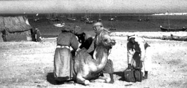
While not overtly a demonstration of the old architecture of the peninsula, I have included this photograph as it gives an indication life in Doha in the early nineteen-foties. It shows a camel being loaded at the port, presumably the area immediately north of the suq, now referred to as suq waqf. To the left of the photograph is the end of a temporary building that appears to be a barasti construction with a pitched roof.
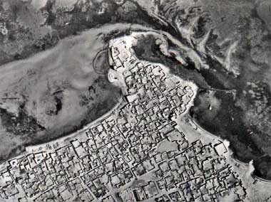

The photographs above illustrate something of the character of Doha which lived on until the early nineteen-seventies when the whole of residential accommodation in the central area began to be demolished. To give an even better indication of the texture of traditional housing, here is an earlier photograph of the feriq al-Sharq area of Doha, which was situated on a promontory north of the old development of Sheikh Abdullah bin Jassim, north of feriq al-Salata, a small peninsula subsequently incorporated into the port area. Note here the pattern of reefs protecting and constraining the use of the littoral, and the fish trap to the west of the end of the peninsula. The present area known as al-Sharq is around a kilometre south-east of the area shown here, across Doha’s east bay. I can’t be certain of the date of either of these two photographs, but the top one is the older. I had thought that the lower photograph was taken in the early 1950s, but believe the image from which it is taken is similar to one I have seen dating from the late 1940s. Its significance is that, compared with the upper photograph, the area has been abandoned and the buildings are falling into disrepair.

Here is a view of Doha taken in 1952 and shows the urban development with feriq al-Salata in the foreground. The al-Sharq development can be made out in the bottom right hand corner of the photograph and Sheikh Abdullah’s complex would be out of picture on the left. The sprawl of Doha can be seen at the top of the photograph with the jetty stretching out from the end of the suq development. Behind it is the development of Sheikh Jassim with its associated jetty just visible and the road leading to Rayyan moving out of the picture and top right. The road on the left leads to Wakrah. Beyond Sheikh Jassim’s development is the settlement at al-Bida. Note the shallow waters edging the littoral, and how development tends to cling to the shoreline.
Although it is difficult to spot in this photograph, the small horizontal white shape slightly above and left of the centre is the al-Qubib masjid, of which there are photographs below.

This photograph must have been taken around the same time as those above and is looking around south-west across al-Sharq and feriq al-Salata. In this photograph the masjid in the foreground is the dominating feature of the urban development. It is a simple building, very much in the wahhabi tradition that produced architecture which lacked ostentation but created beauty through simple lines and proportions. The building can be seen in both the oblique and plan photographs above it. It is interesting to see how close to the water’s edge the masjid has been built, as well as to observe the simple nature of the housing.

Doha was overflown again in 1952, this aerial photograph having been taken from approximately the north-east. While the detail is not easy to see there are some features that are identifiable, even at this scale. The open space in the centre of the photograph is the central maqbara with, to its left, the al-kuwt, or Turkish fort. The new palace of the Ruler can be seen standing by itself just above mid-centre and, running along the coastline to its right, is the old town of al-Bida. Where the coastline runs out of picture on the right can be seen the masjid al-Qabib. The old suq al-Waqf can be seen between the sea and the maqbara. Out of picture, below the aircraft would have been the old palace of Sheikh Abdullah bin Jassim at feriq al-Salata. It can be understood that Doha was, at that time, at least three separate conurbations spread along the sea edge – al-Bida, Doha and al-Salata.

This photograph illustrates something of the character of housing in the middle of the twentieth century, the buildings being predominantly single storey with the the occasional first floor added as well as the manaaraat of masaajid visible. One of these is extremely obvious in the centre of the photograph and suggests it belonged to one of the new masaajid being introduced to the country, though there is a small manara, partly hidden, near the right hand side of the photograph. I believe the viewpoint may be looking approximately west or north-west over a part of feriq al-Salata, but am not sure.

This character of low building development with manaaraat rising above them was characteristic of Islamic developments over a wide region, not just of the Arabian peninsula but also of Iran and the areas immediately to the north, east and north of the eastern end of the Mediterranean. To illustrate this low scale of development compare the photograph of the derelict part of Doha above with the colour photograph below it that was taken in Isfahan in 1975. Note, too, that it is not manaaraat that rise above the rooftops of Isfahan, but qubaab and trees.
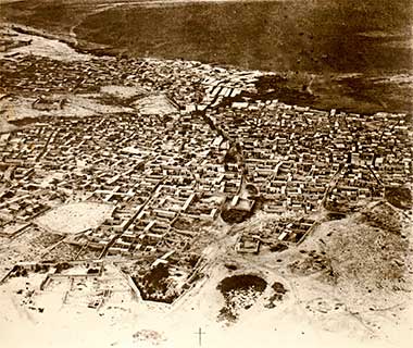
The photograph originally here was another found one, attributed to the Ministry of Information but having no date associated with it. This photograph is a better version of it. On inspection it seems to have many similarities with the photograph above, which was taken in 1952, and I suspect this may have been taken on the same run. Having written that, I have found a copy of it dated on the back at 1947. The reason it is placed here is that it has a rough quality to it which seems to accord with the character of the architecture of that time. It also clearly illustrates two of the main sikkak leading to the main suq and port at that time. The wadi musheirib runs horizontally towards the top left of the photograph, the Turkish al-kuwt fort just above it and adjacent to the maqbara.
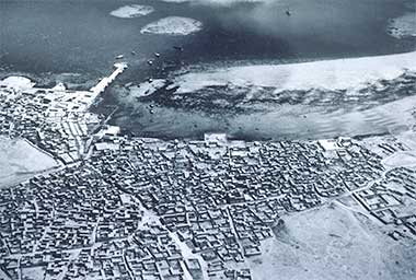
This aerial photograph was taken, I believe, also in 1952 and may have been made on the same run as that above. Again, it shows the grain of the urban structure of Doha at that time, particularly the wadi musheirib and its relationship with the bay. What is particularly noticeable is that the foreshore is protected by a sand bar which, while allowing small craft to be drawn up, also constrained use of that part of the shore for commercial or other development. On the top centre edge of the photograph can be seen two, and a part of a third, outcrops of a hard material which, for a time constrained development in being too hard to remove. In fact the new wharf for the fishing and trading craft was incorporated over them.
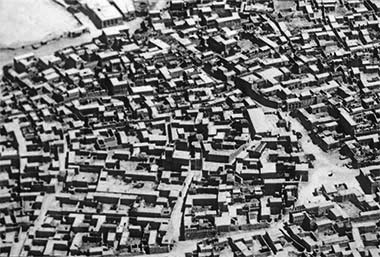
This photograph is of a similar area of Doha, but shows more detail and was taken from a steeper aerial perspective looking approximately north-west. In fact, I suspect it was taken from the same image. I don’t know the date of the photograph as I took it from a document a long time ago, but I believe it dates from the late 1940s. Again, wadi musheirib runs across the top left of the photograph with the east corner of the main maqbara just visible. A number of sikkak can be seen leading north towards the suq with one of them apparently wider than the others. There are two interesting points to make: firstly, there is only one masjid in sight, just right of centre – though there is one just out of picture at the top of the photograph – and, secondly, there are no burj al-hawwa to be seen.

Here is another oblique image of that area of central Doha, feriq al-Jufairi, and was again taken in the 1940s. Captured from a more shallow vertical angle, but from a similar direction, it is relatively easy to compare the two images. The triangular open space towards the bottom right edge of the photograph above can be identified with that towards the centre near the top of this photograph; and a part of the central maqbara can just be glimpsed at the left of the top edge of the photograph. As might be anticipated, it is clear that the housing plots are generally larger as they move away from the centre of the suq with most of them lying adjacent to the wadi which annually took water to the bay to the north. Flooding in the suq due to this was an issue until the early 1980s.
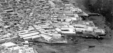
This image shows the centre of the suq in a little more detail, looking from the east. The wadi leading to the sea is clearly seen with the main shopping area to the far side, west, of it. In the left bottom corner is the masjid. The wadi is now the paved road through the centre of suq waqf, and the masjid remains in the location shown. The suq extends north approximately as far as the old police station of the nineteen sixties, and boats have access right into the suq, the masjid being around 330 metres from the present shore line.

This aerial photograph was taken in 1954 and is said to show a part of the outskirts of Doha at that time. Inspection of the photograph suggests that it was taken looking more or less south, though I have not been able to work out exactly which part of Doha it shows. There is the beginning of a road leading out of the photograph top left, and a maqbara is cut by the bottom edge at its centre. The housing plots are generally orthogonal and laid out in the same direction – with one large, single exception near the top centre – and the spaces between the boundary walls are relatively narrow suggesting they were established in the nineteen-fifties. All the buildings are attached to boundary walls which also suggests the same time period.

Urban grain is always interesting as a guide to the character of an Arab town. This photograph is a detail taken from one of the oblique aerial runs made to record parts of Qatar in 1952, and looks approximately north-west with the sea near the top edge of the photograph. The larger image can be seen above. It shows the area immediately to the west of Doha’s central suq, now known as suq Waqf. The buildings are a mixture of one- and two-storey constructions with the ground floor ceiling heights relatively tall. These were the properties lived in by many of the merchants operating in the suq. Because of this the houses were also used for storage of goods and there would have been considerable movement of materials around the sikkaat with, for the heavier goods, the use of porters and their carts. Interestingly there seems to be no rule governing the orientation of the first floor constructions as there was at Wakra. While the sea lies to the east of Wakra with the first floor rooms generally facing it, the sea lies to the north of the centre of Doha. In addition activities in Doha were more oriented to commerce, Wakra to fishing and pearling. It is also notable that there seems to be little or no trees in this part of the centre.
Fortified structures

The Ottoman Empire established a fort in 1880, known as al-kuwt, on the rising ground west of the centre of Doha in order to control this strategically important port on the east coast of the peninsula. I am uncertain if the Turks constructed the building or if they occupied an existing structure, but believe the former to be the more likely. A small force was garrisoned in the al-kuwt, but left with the signing of the protection agreement of 1916 between Great Britain and Qatar. Subsequently al-kuwt was used as a prison for a time, this first photograph of it, being said to have been taken in 1945 or the early 1950s, depending on which source you look at.

The second photograph, taken from approximately the south-east, is not of great quality, but is included as it shows the internal form of the structure and its single, small, entrance. A detail of a photograph taken in 1952 it illustrates how the accommodation is built into the walls of the fort, providing a fire step above it. The line to the right, outside the fort, is the wall surrounding the central maqbara, now the site of the parking area adjacent to suq waqf.

This aerial photograph, taken from almost due south, and of better quality than that above, makes an important point about the internal layout of the al-kuwt fort. There is an open musalla, its mihrab pointing towards Mecca on the left or west. The main entrance to the fort was in the east, right, wall and was changed to the west wall at a later date but returned to its original, or almost original place, later. Entrances were made to the higher level of the corner towers from the fire step, with continual access through the rectangular tower along the fire step.
One point of note is that the main accommodation has been made in its south-east corner adjacent to the main entrance, presumably for military reasons. Traditional development of compounds in the peninsula favoured the north and west for environmental reasons and it appears that there is accommodation for the troops around the perimeter of the compound, forming the fire step.
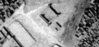
There is a small entrance on the east wall facing the suq and maqbara which would make more sense as it would have been that more easily defendable. The accommodation to its south would support this. The maqbara had a wall around it for some time but it is likely that the area around al-kuwt would have been kept clear to keep firing lines clear. Having said that, an earlier photograph shows a building close to al-kuwt on its south side. I don’t know who built it, nor its purpose. In this lower photograph the ’eid masjid is on the left.
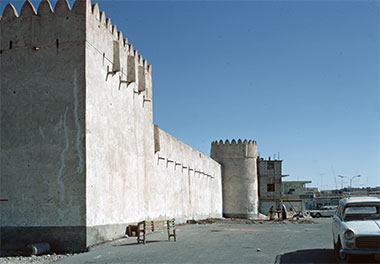
In March 1972, this is how the fort appeared, the photograph taken looking approximately south along its western wall. Across the road was what was referred to as the ’eid mosque and, at the end of the road, bottom right, the Arab Bank roundabout. This is how the al-kuwt fort appeared in its original form – the following years seeing a number of changes and interventions being made in order to provide housing for a museum and exhibitions, and then being returned to something similar to its original form, but with significant differences. More about its recent history can be read on another page.

While al-kuwt had its origins in the need to defend the commercial centre of Doha and was later used as a prison, it also became the location for some of the armed guards who patrolled the suq at night, a service paid for by the merchants who operated there. Here two of them pose to be photographed in June 1972. I understand that there were also less formally dressed guards living above the shops in the suq, perhaps a less expensive option for the merchants as they might also be employed in the shops by day. I may be wrong, but their dress suggests that at least the guard on the left is not a badawi, though that on the right may be, guards traditionally being found from among the badu.
The kuwt was constructed on rising ground south of the suq. The form is similar to desert developments in that a surrounding wall gave protection to an arrangement of rooms inside it. Inset in the walls and defensive towers there are fat’ha al murakaba, small holes in the walls which allow protected viewing and some ability to use small arms against attackers. You can also see on the photograph a number of mirzam designed to throw rain water away from the building, in this case also allowing some of the function of the fat’ha al murakaba.


However, although I have located this first photograph here in the context of Doha as it is officially labelled as being the al-kuwt, I am certain the photograph actually shows the fort at Zubara as there are significant differences between the two buildings. Compare it with the photograph above of the al-kuwt in Doha and, particularly, with the two photographs below it, the first of which is taken from a similar angle, from the south, though from a greater distance. The lowest of these photographs shows the Zubara fort from the north-east. The white marks in the centre photograph are likely to be patching to cracks in the walls, suggesting that the photograph was taken in the nineteen-fifties. The Zubara fort was constructed around 1938 in response to concerns for deteriorating relations between Qatar and Bahrain. It was used both as an outpost as well as a prison. Neither of these photographs are to be confused with the fort that was constructed immediately outside the town of Zubara, known as Murair, a fort constructed by the ’Utub in the eighteenth century, designed to protect the town from sea-borne invasion, and now ruined.

As mentioned in the previous paragraph, the north-west of Qatar held a particularly strategic importance in the history of Qatar and Bahrein right into the latter part of the twentieth century. Because of this there were a number of alterations made to the fort at Zubara reflecting the requirements of garrisoning the structure. Its architectural profile altered a number of times as well as its plan form. This image, taken in the 1960s, together with that immediately below show the fort with its extension to the south-east, later taken down and the structure returned to its original plan form as can be seen today.
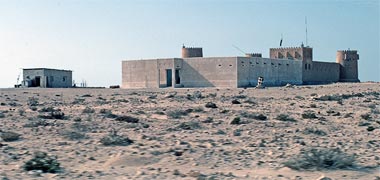
The above photographs can be compared with this one, taken in March 1972, and looking at the fort from the south-east. At that time it was being used by the police or military and had been extended to around twice its original size in order to contain a more useful garrison in what was considered to be at that time, a politically sensitive area of the peninsula. The evidence of modern aerial photographs is that this extension no longer exists and that the fort has been reduced to its original form and functions as a museum.
As you can see, the two fortified structures above are relatively small and would not have been able to house, protect and sustain a sizeable military garrison and their associated administrative personnel. Here, however, are photographs of two larger fortified developments.

This is a rare photograph of the fortified development at al-Wakra. Constructed by Sheikh Abdulrahman bin Jassim al-Thani over a hundred years ago, the photograph shows the development on the left with, on the right, the four bays of the iwaan of Sheikh Abdulrahman’s masjid. The photograph was taken looking from the east and shows the development in considerable ruin. I don’t know the date of the photograph. Sheikh Abdulrahman was appointed by his father, Sheikh Jassim bin Muhammad al-Thani, to represent the town in 1898.
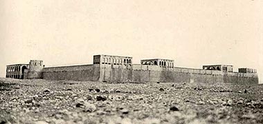
When I originally posted this old photograph, I noted that it had been taken in the nineteen-fifties and believed it to be the fortified development at al-Wajbah, west of al-Rayyan. However, it has been pointed out to me that it is not that fort, but the old Diwan al-Amiri complex just north of the centre of Doha. Regrettably, it means that I have no old photographs of the development at al-Wajbah other than those I took there in 1981.
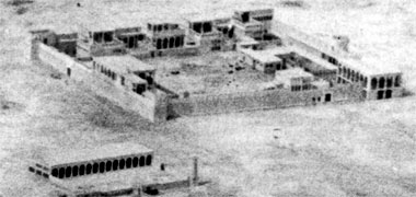
This photograph is thought to have been taken around 1952 and shows the Diwan al-Amiri from, approximately, the south-east with the old Sheikhs’ masjid in the bottom left foreground. If the salient features of the building in this photograph are compared with those above it is evident that they illustrate the same building complex. The photograph above would have been taken from, approximately, the north-east, down by the old shoreline showing the majlis facing out over the bay. Entrance into the complex was from the east and south.


The above examples of fortified structures are mainly distinguished by a surrounding wall within which there are separate or attached buildings to house the personnel living within the forts. The surrounding wall has corner towers both to strengthen that part of the wall as well as to enable observation and enfilading fire if necessary.
But there were other types of fortified buildings in the peninsula and that at Umm Salal Muhammad north-west of Doha is a significant example. This first photograph of the structure was taken some time in the 1950s from approximately the west, the second in 1956, approximately from the south.
Said to be founded in 1910 by Sheikh Muhammad bin Jassim al-Thani, Umm Salal Muhammad is a small settlement in the centre of the country and is different from most of the other urban developments in Qatar for that reason. Its climate is drier than the conurbations on the littoral, and it has a gardened area of date palms with ground crops beneath them supported by a reservoir of water contained by a small dam. In the 1970s there was little water to be seen in the reservoir, the rumour being that drilling into the reservoir had created the means for water to escape.
To the south and west of this resource a coalescence of residential development grew up as can be seen in the photographs, the development including a masjid to the north of the structure and west of the reservoir. However, compared with Doha and Wakra to its south, Umm Salal Muhammad was relatively poor and, to some extent, this demonstrates one of the differences between the badu, interior settlements, and the trading and fishing settlements on the coastline.
This photograph was taken in March, 1975 and shows the elevation of the residential structure facing south-east with its tall semi-circular headed arched iwan apparently at odds with the detailing of the heavily fortified walls. The construction of the columns can be seen to be heavier than might have been expected in a residential building, such as would have been seen in Doha; nor were there timbers between the columns to provide additional support, as was a feature of many residential constructions. While apparently abandoned, there was evidence of people living in and around the courtyard at that time.

As mentioned above, the development at Umm Salal Muhammad was constructed by Sheikh Muhammad bin Jassim bin Muhammad al-Thani prior to the First World War and there is an obvious connection to the architecture of the Nejd. I believe that Sheikh Muhammad was also responsible for the structures now termed the Barzan towers, in 1910, and to the east of Umm Salal Muhammad, this view of one of them being from one of the defensive openings in its walls, facilitating easy communication between them. This was to be his winter quarters from which Umm Salal Muhammad could be overlooked as well as any intrusion moving south into the peninsula.
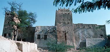
In the flat landscape of this part of the peninsula the development contains a tall tower which permitted anybody in it to see some distance and give warning in the event of attack. In addition to the residential development there is also a pair of towers to the east of the town which, I believe, were constructed purely for this purpose. This view of it, taken in February 1976, shows the view of it from the gardens to its west.
Strictly speaking the next images are not fortified structures but have been included to show a little more of the setting of the main fortified structure within Umm Salal Muhammad which was an extremely attractive piece of urban landscaping.
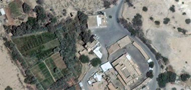
The next two aerial photographs are instructive in that they demonstrate what is happening with some old structures in the peninsula. The first is an aerial photograph of the fortified house in its setting in July 2011. The gardens to its west are clearly seen as is the masjid to its north. The residence to its south within its containing wall is also evident and was inhabited in the 1970s and, I think, 1980s. To the west of the structure and across the road was the dammed wadi which filled in winter.

It is also significant that there were changes to the grouping prior to the area being recorded from the air. In the 1970s the masjid had a different form with there being an open courtyard flanked by a burj on the south-east corner compared with it being on the north-east corner as shown above. In addition, to its north and just out of picture here, there was a building with porch facing south and, to its east, a small square open prayer area. This photograph shows the masjid from the east in March 1982. A little more of this masjid can be seen in two images on one of the Gulf architecture pages.

Taken in November 1977 looking towards the position from which the above photograph was taken, this photograph shows the old building which backed onto the planted area to the north of the grouping, and faced the north wall of the old masjid. To its right, and painted white, was a raised square area which at first I assumed was an open prayer area but, on reflection, was more likely to have been a open area established as a majlis or baraha.
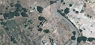
Here, however, is the aerial view of it taken two years later, in July 2013. Everything around it appears to have been demolished. The house and its compound, the masjid and gardens have disappeared and something seems to be happening to the dammed wadi. I have no idea what plans there are for it but my recollection of the whole grouping is that it was one of the most attractive natural groupings in the peninsula. Admittedly the single storey housing was sub-standard, the strongly articulated ground modelling combined with the trees of the gardens made this a lovely place to visit.
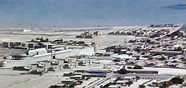
Finally, here is a more modern structure, but one which replicates the pattern of the traditional forts of the peninsula, albeit on a much larger scale. This oblique aerial photograph was taken around 1968 and shows the fort at Rumaillah, looking approximately north-east. Housing both Police and Army headquarters, the fort, around 250 metres square, was constructed on the high ground, north-west of al-Bida and around 600 metres from the sea, which can be seen in the background. The line of the shore there changed with the development of the New District of Doha and the associated Corniche.
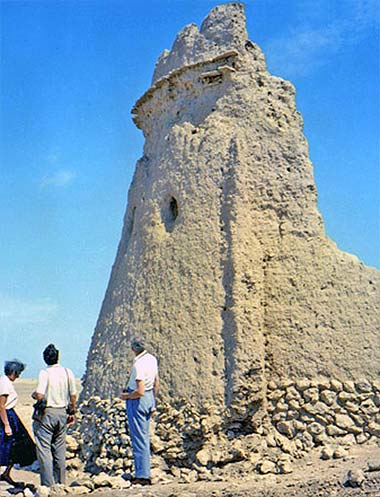
This photograph was discovered on an official government site. Many of its photographs can be found elsewhere, but this is the only image of this particular structure I can find. Regrettably there is no accompanying description so I am unable to locate it. From the style of dress I would guess the photograph was taken in the 1960s.
It is not clear to me from the photograph how the tower was constructed. Originally I had thought it was not of hasa but of mud bricks, but have been informed that it is of masonry construction. I wonder if there was a form of construction which utilised mud but added small stones as aggregate. Certainly the upper construction appears to be radically different from its base.
I also believe that this is likely to be a corner tower for an protected space contained by a wall. A trace of the wall can be seen, thick at the base and narrowing to the top. Like the corner burj the wall is founded on around a metre height of hasa for stability and strength. There are fat’ha al murakaba in the walls and the top of the burj has been articulated with shurfa, both designed to protect those defending the development. There is still the possibility that this might be a free-standing tower, and that a structure has been added to it at a later date.
It is unclear why defensive structures of this sort should be built of mud rather than hasa, but there may be a number of explanations. From a structural point of view there may be few hasa in the immediate area, but enough quantities of soil to use in a teen construction. A secondary reason may have to do with the time required to construct a stone or teen structure. This would reflect the urgency with which the building was required. One peculiarity about the burj is the location of the fat’ha al murakaba with respect to the walls. A better location would have the fat’ha al murakaba nearer to the wall in order to permit enfilading fire from the defenders along the wall.
The White Fort at Anaiza
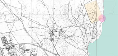

This next group of photographs relate to an old fortified residential complex just to the north of Doha, an area now completely covered by the development of the New District of Doha. My attention was drawn to it through attempting to discover more about an oblique aerial photograph, taken in May 1975, of a small complex of buildings adjacent to the coast in what turned out to be – with the assistance of staff of the Origins of Doha project – the area now covered by the New District of Doha. The first of these two illustrations shows the location of the building, the second shows the area and its relationship with the New District of Doha in 2017. The area marked in sepia on both illustrations is the site on which radio aerials were erected, I believe in the early 1940s, around which a wire security fence was constructed. The area was known as Anaiza though it appears now to be referred to as Unaiza or Onaiza.

This animation is intended to show two aspects of old development in this part of Qatar. Firstly, the location of the building photographed in 1975 that led me to learning a little more about the development at Anaiza – this is located by the red dot; and, secondly, the location of the whole of the Anaiza development which is shown superimposed on the radio aerials site and was known as the White fort. What is important about the map is that it shows the south-east corner of the security fence as a re-entrant in order, for reasons yet to be determined, apparently to avoid conflict with the building.
I’m told that the White fort was a feature of Persian Gulf marine charts, acting as an aid to navigation until the late 1940s. Presumably its towers would have been of a similar height to those at Doha and al-Bida.
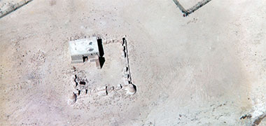
This photograph was taken or developed in May 1975 and is interesting for a number of reasons. It took some time to locate where it was taken, and that was only with the assistance of staff at the Origins of Doha project. The photograph was taken from approximately the south-east and shows the development in ruins with, at the top of the photograph, the corners of the re-entrant security fence of the radio aerials site. The development sits in an area where there is considerable sabkha, and the bottom right corner of the photograph shows its proximity to the shore line. When working the area just to the north of the radio aerials, the government’s Engineering Services Department had considerable difficulties caused by working on the sabkha.
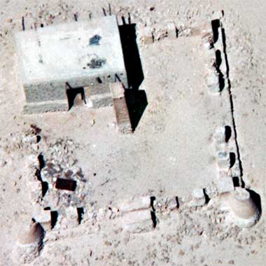
The larger photograph is a detail of the first. Regrettably this is the only photograph I have of the building and it is difficult to make out the details of its construction. However, the building appears to have been constructed of concrete blocks raised on a buttressed base of desert stones. Its single entrance faces due east and its roof is flat, apparently constructed in the traditional manner with danjal mangrove poles and at least one mirzam to move rainwater off the roof – though I believe this would be insufficient. I have no idea what the central, reddish, structure was. It appears to be different in character from both the building as well as its surrounding structure, the only similarity being that it is the same height as the room, and possibly connected to it.
But it is the surrounding construction that is difficult to understand. It appears to consist of a series of square desert stone columns sitting on a wider base, with infill panels, apparently of desert stones, that have collapsed. On the east side there is a solid feature whose purpose I can’t guess at and, on the north side, apparently an entrance. As for the two corners on the east side, they appear to be solid circular constructions resembling traditional circular corners structures of fortified buildings, but on a much smaller scale.
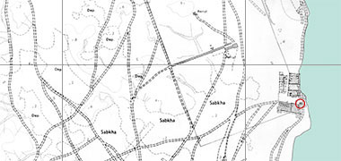
There is evidence that this small building was connected to the larger development at Anaiza on its south-west side or corner, and this seems to be borne out by the oblique aerial photograph as well as by the overhead aerial photograph. In this illustration, the White fort, as the larger complex was known, has been superimposed on the 1971 plan of this part of north Doha, with the small building circled in red.
The development at Anaiza was the residence of Sheikh Khalifa bin Qassim al-Thani, the second of the nineteen sons of Sheikh Qassim bin Muhammad al-Thani. Sheikh Khalifa was born in 1851, and died in 1931, which may suggest dates for the occupation of this development and for its abandoning.
The al-Thani family scattered their residences around the peninsula both inland and, as here, on the littoral. Sheikh Khalifa’s younger brothers, Sheikh Abdulaziz, Sheikh Muhammad and Sheikh Ali were the shyuwkh respectively of nearby al-Gharafa, Umm Salal Muhammad and Umm Salal Ali with Sheikh Fahad the Sheikh of al-Khisah, Lusail and Rumaillah. Another younger brother, Sheikh Abdullah, the Sheikh of al-Rayyan, became the Ruler of Qatar with his development on the littoral at feriq al-Salata being made into the first National museum.
Right into the beginning of the twentieth century there were political issues that saw a concern for conflict on the peninsula. Because of this most, if not all of these residential developments, had elements of a defensive character. Usually this was confined to a relatively small area of the development and consisted of a high containing wall with round and square turrets at the corners. In the case of Anaiza it is difficult to work out exactly how the development was guarded.
Here is the only image I have seen of the White fort at Anaiza, a photograph taken by the Royal Air Force and reduced for the purpose of superimposing it on the plan above.

The fortification appears to be confined to the south of the development with a circular tower in the south-east corner and, perhaps, one on the south-west. There is evidence of structural planning to accommodate family and retainers of the Sheikh. The family’s residential accommodation appears to take up the northern part of the development while in the southern part, to the west of the fortified south-east corner, there appears to be smaller repetitive courtyard housing, perhaps for guards or retainers. The south-east corner of the development, with its rhomboid shape, looks as if it was designed as a fort, but there is rarely building attached in the manner in which it is to its west, as this would weaken its purpose. However, the possible tower on the south-west corner would suggest an attempt to extend the fort defences, incorporating the residential element.
The manner in which the development was laid out shows a continuous wall around the north, west and south sides, but is broken on the east adjacent to the sea where there is a masjid, an important element of this type of housing, its position enabling all to visit regardless of status. It is probable that shallow draft traditional boats were pulled up onto the shore at this point in a similar way that was witnessed at feriq al-Salata.
It is evident that the Government will have purchased the land in order to construct the radio aerials, and this land would previously have been in the ownership of Sheikh Khalifa and his family. The exchange would most probably have taken place some time after 1931 when Sheikh Khalifa died and assuming the family moved to better accommodation elsewhere. The buildings would have been allowed to collapse naturally, though it is possible that some of the elements of their construction were stripped out and removed to use on new constructions.
As for the curious building addition which began this search for evidence, it is still impossible to state its purpose. The evidence of the RAF photograph is that it was constructed after the rest of the fort was abandoned or, if it was added when the fort was occupied, then it is likely to have had a different function. Previously I have noted that it seems to be of concrete block construction and would, therefore, have been a later addition and less likely to deteriorate – though this would not necessarily apply to the roof construction.
The building seems to me to be
- too small to have been a majlis – and there appears to be no evidence of an external baraha arrangement that I would have anticipated,
- too early to have been constructed for soldiers guarding the radio aerials – though it may have later had this function either for the border police, coastguards or for Cable & Wireless guards,
- too weak structurally for a defensive element,
- not tall enough to have been a defensive tower, and
- uncharacteristic and too complex to have been a sally-port.
If anybody has more knowledge or a suggestion, please let me know…
Development in Doha

This is the oldest aerial photograph I have come across showing Doha. Taken in May 1935 from a British Royal Air Force flight and looking approximately south, it establishes the character and extent of Doha at that time with the town expanding to the east and south. The photograph illustrates the consolidated shoreline just right of centre, where leading merchants developed the littoral in order to create areas for the goods they imported to be landed and stored. The set-back, left of centre is the original harbour where the wadi Musheirib met the West Bay and behind which suq Waqf was and is situated. I’m not sure, but it is possible that the dark area situated some way south of Doha is al-Nuaija.

The Turkish fort, al-Kuwt, is clearly seen sitting behind Doha’s central maqbara and, although it can not be seen at this scale, the al-Qubib masjid is near the foreshore on the left of the main photograph above. The area of shallow water is evident on the left and the three reefs a little way offshore are clearly seen, later forming part of the structure of the first proper harbour.
Note that the masjid in the centre of the suq is situated to the west – right – of the wadi, whereas it is now situated on the east of the wadi, now the main road through the suq, though I don’t know exactly when the development of the road will have established this.


The area of old Doha in the centre and adjacent to the sea, is the area of feriq al-Jasrah, now some distant from the sea due to the creation of two roads running east-west, first that trimming the edge of the sea and, later, the installation of the Corniche. These two photographs were taken in 1945 from buildings fronting onto the west bay of Doha in feriq al-Jasrah. The first looks approximately north-west, the second approximately south-east. Behind the buildings in the first photograph, the rise on which the Diwan al-Amiri was constructed can be glimpsed with the littoral of the west bay moving north to the right of the photograph. In front of the buildings in both photographs can be seen the unpaved foreshore with, in the lower photograph, a rowing boat drawn up. Small craft enabled the larger boats to be unloaded and their goods brought straight ashore to the houses of the merchants living by the sea. I believe that the building in the lower photograph belonged to the al-Mana family. Behind the lower buildings can be seen the masts of abwam in the main harbour of that time.
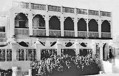
This photograph was taken in the 1950s and shows a building which is said to have housed British residents, perhaps associated with the British political presence of the time. The building shows the influence of Bahraini architecture in its simple trabeated form. The open nature of the façade and front wall shows it would not have been lived in by a Qatari family. The decorative treatment in the angle between columns and beams is simple but refined, enlivening the rigid orthogonal architecture of the building.
al-Jasra street was the name of the road that was constructed to the north of, and along the frontage of Doha’s centre, crossing the central suq and extending to the Clock Tower roundabout with its associated development. The buildings above fronted onto this new road.
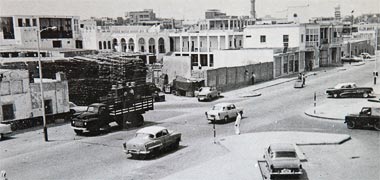

The first of this group of three images, in monotone, shows how the road appeared in 1956, the photograph looking approximately south-west. The old Customs House with goods stacked in its yard is on the left, adjacent to the Police Station out of picture. I believe that the development to its west is the Al Mana residence from which that family carried out its commercial business. The photograph was taken from the roof of a government building for the Ministry of the Interior, I think associated with Customs.
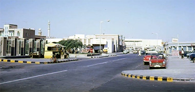
The second photograph was also taken on al-Jasra Street – the name later changed to Abdullah bin Jassim Street – this time in March 1972 and from a position on a parking bay at the right hand edge of the first photograph looking west. Qatar National Bank is on the left and the shadowed façade of the Diwan al-Amiri can be seen as the focus behind the small Darwish masjid at the end of the street.
The third image was taken on a morning, some time in the 1960s, and is a similar view, but from slightly further east. The railings enclosing the Central Police Station railings are on the left and the building in the centre is the Chartered Bank building.
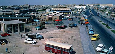
This image was taken in April 1972 and looks west down the full length of al-Jasra from Jabr bin Muhammad Street with the Diwan to be seen in the top right corner. Government House is just out of picture to the right and, on the left there is a sub-station behind which was the animal market. The brown single storey building was the fish suq al-samak, or fish market and, behind it was the two-storey Central Post Office. Incidentally, although I have called this street al-Jasra, I believe it is now known as Abduallah bin Jassim Street.

Taken in 1957, this photograph illustrates the link between the enlarged jetty and the suq, as well as the prominence of the merchants’ properties that lined the old littoral, and on which the al-Jasra Road was constructed. Note how the sea is being filled to create more, and valuable, land as well as getting rid of the irregular shore line and shallow waters. Tied up to the west side of the jetty can be seen lighters or barges used to transport goods from the large ships standing out in the roads to the shore.

This photograph is very similar to that above but appears to have been taken a little while prior to it. The shore line in the photograph above can be seen to have been developed through reclamation and the boats drawn up on it here, are no longer present. The area reclaimed on the right of the photograph above was developed by the Darwish family with a masjid and their Cold Stores established opposite the main entrance to the Diwan al-Amiri.
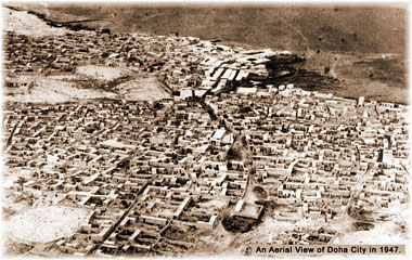
This aerial photograph was taken in 1947 according to the date written on it, and looks down on Doha from the south-east. Comparing it with the square photo six photos above, suggests that it might be earlier than that as the latter shows a constructed jetty. Perhaps it is more likely that the above photograph was taken later than was reported in the source from which I took it. At that time the wadi from the hinterland brought water through the suq in winter but was also the main access route through the suq to the sea and jetty. This is a common system for the location of routes not only in the Persian/Arabian Gulf, but elsewhere in the world, though has the disadvantage of creating difficulties in the rainy season both for those using it as a route as well as for those living and working immediately adjacent to it. This was certainly the case in Doha where winter rains caused significant problems.

This aerial photograph of the centre of Doha was taken in 1949 and looks approximately south or south-east over the developing centre. The al-kuwt, the Turkish fort established by the Ottomans to control Doha, can be clearly seen and in front of it the main maqbara for Doha. A little way to the right of the al-kuwt can be seen the open air eid prayer ground surrounded by a low wall. The dark diagonal line across the top of the photograph is, I believe, a track leading to the important development of Wakra and on to Umm Said, where development was starting relating to the export of oil.


Many years ago I wrote that I had thought this first of two similar photographs was also taken in 1947, but then believed it was made a little later, perhaps 1950. But a second photograph has appeared, bought in the suq with, written in Arabic, ‘Year 1947’, suggesting it was, indeed, taken in 1947. Of much better quality than the first image, the second photograph appears to be a crop of the first photograph.
Taken from the north-west, the covered suq can be seen to the west – left – of the wadi with the main maqbara behind it. Note that there is a simple foot bridge over the wadi. At the south side of the maqbara is the al al-kuwt fort. On the sea front can be seen some of the compounds of the major merchants of Doha who had established themselves near to the shore where their goods were landed. Four small local boats sit by the shore, used to transfer goods from larger craft unable to navigate closer due to the shallow waters. There are more detailed photographs of this area on the Gulf architecture page, apparently deetails from the same image.

The fifties saw the beginnings of development along Doha’s foreshore. This first photograph is from 1955 and looks south-west towards the rise on which the Diwan al-Amiri was developed on the site of Sheikh Abdullah’s complex which can be clearly made out on the higher ground behind the dhow. On the left of the photograph is the manara of the Sheikhs’ mosque.
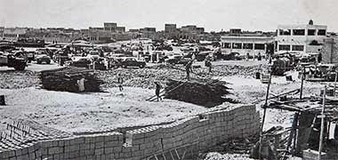
The first of these three photographs of parts of Doha was taken in 1958, and is of the site where the Darwish offices were constructed at the north end of the suq with the dhow jetty to its north and the Police station to its west. There is evidently considerable building activity with a stockpile of concrete blocks in the foreground. Interestingly there are also two prominent piles of mangrove poles, normally used in traditional buildings as danjal or floor joists.
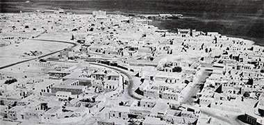
The second photograph was taken in 1960 looking over Doha to the north-west. The old palace compound of Sheikh Abdullah in feriq al-Salata can be seen to the right silhouetted against the sea. Behind it is the area in which Doha port was developed in the nineteen sixties and later. One interesting aspect of the photograph is what appears to be the beginning of structured residential development to be seen in the right foreground of the photograph, though much of the rest that can be made out follows old tracks. In those days, of course, there would have been little commercial development in these areas, most being concentrated in Doha’s central suq, though there were local shops providing a service reinforced by travelling salesmen selling everything from water and oil to clothing, materials, brushes and the like.

The third photograph is a detail of the second and shows a group of residential compounds in feriq al-Hitmi. The compounds, being on the outskirts of the feriq are relatively spacious and well developed. One or two of the compounds incorporate covered verandahs, but it is surprising to see so many rooms without them. Note that there neither two-storey development as there was at al-Wakrah, nor any badgheer to be seen, indicating that this is was not a well-off area.
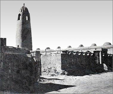
There is more written about this particular photograph of a building on one of the Gulf architecture pages, as I now believe it to be a significant and important structure. The photograph was taken in the 1950s and appeared on the cover of a booklet published in 1977. I believe the structure to be the al-Qubib masjid, also known as the Qassim bin Muhammad al Thani masjid. If I’m right, it was demolished and another masjid took its place, also known as the al-Qubib masjid or, more familiarly as the ‘pigeon’ masjid, itself also demolished. The term qubib refers to dome structures and, as you can see, the masjid must have been the first, if not the only, early masjid to incorporate domes over its musalla. Just as impressive is the gadrooning applied to the top of the manara. This would have been the view south-west from Al Ahmed Street.
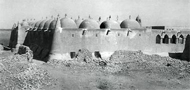
I am unsure as to whether this photograph and the next two below are of the al-Qubib masjid, though they are two of the earliest photographs of Qatari architecture I have come across. Compare this photograph with that above it, this being taken looking, more or less, north-east and appearing to show a feature on top of each cupola that seems not to be present in the upper photograph. Moreover, the top of the manara appears to be different in that it appears to be taller in the upper photograph. Nevertheless, the south-west corner feature of the masjid is clearly defined, along with the haunching at ground level, as is a run of pointed arches on the south wall of the courtyard. There appear to be ventilation openings at a high level of the musalla as well as the standard maraazim to shed water from the roof.
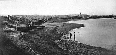

Here is another view which includes a masjid with domes across its roof. This time the masjid appears to be the same one as that above it as can be seen in the enlargement in the lower of these two photographs. The upper photograph was taken by the German traveller, Herman Borchardt as he was travelling through the Gulf in the winter of 1903 and Spring 1904. The view appears to have been taken looking west or south-west from feriq al-Salata where there are a variety of boats, notably the bateel and baqaara prominent among them, drawn up and propped along the foreshore. The al-Qubib masjid – if it is that – stands out in the background with little construction of a similar height to be seen around it. The masjid must have been an impressive sight in those days. The masjid was located east of the centre of Doha and west of the palace complex of Sheikh Abdullah bin Jassim.

Fifty years later, this is how the al-Qubib masjid looked from the air in 1952. Taken from a larger image, the photograph lacks a little clarity but it shows that a large building, most probably a majlis, has been built outside and to the east of the north-east corner of the of the masjid. The building can be seen to have four bays suggesting that it is larger than the usual constructions which reflected the normal span of their supporting beams at three bays. The sea shore occupies a similar position as it did fifty years previously and a number of buildings outside and to the south-east have been built or developed into two-storey structures.
Interestingly it was noted that there were considerable problems caused by the rains damaging houses in Doha, and that it was only the al-Qubib masjid that was able to provide protection from the rains. The masjid was rebuilt in its second phase in 1878, its design having come about from Sheikh Muhammad bin Jassim travelling to Zubara to confront those who had taken goods from people under his protection. There he saw a domed masjid and, on his return to Doha, had a design based on it constructed by the architect, al-Halimy, but twice the size. The view of it in the photos above would, therefore, be the expanded version of it.

Here is an aerial photograph displayed to the public on the fencing around the Municipality building, late 2011. Reading it, together with the photograph immediately below, would suggest that it was taken at the end of the 1950s or the early 1960s. The edge of the bay has been filled to the east of the country craft jetty and a small road created. Although this image is too small to see, the Vegetable Market, Shari’a Courts building and Ministry of Education have been constructed but the General Post Office and Fish Market have yet to be built to their east. The Darwish Fakhroo office have not yet been constructed. The outline of the Diwan al-Amiri appears to be in place, as is the road arrangement from the Rayyan Road around the Diwan, the Grand Mosque and Clock Tower.
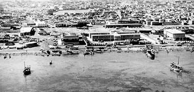
I would guess that this aerial photograph was taken in the early to mid-1960s. Doha’s suq waqf and the fishing jetty are off to the right. The long building is the Ministry of Education, the building to the right or west is the Shari’a Courts building and the building on the left is the main Post Office. On the left of the photograph is a part of the animal market separated from the Post Office by a road. Note that there are buses parked on the road beside the sea as well as boats drawn up. The land here has yet to be filled and Government House constructed on the left where the small local craft sits in the water. Compare this photograph with this below.

This is another of the aerial photographs displayed to the public on the fencing around the Municipality building, late 2011. In this photograph Rumaillah Hospital, Government guest houses and the Guest Palace have been built as has the Diwan al-Amiri development. Land fill from the country craft jetty to the east, in front of the site on which Government House would be constructed, has not yet started which would place the photograph at around 1965.

This photograph is of the Shari’a Courts building, viewed from the north-west. Constructed in the 1950s it owes its architectural style obviously not to local traditions but to the Western colonial architecture being built in hot and humid climates. Having said that, the brise soleilwere, and are, a sensible way of creating a degree of privacy, stopping sun striking the inner skin and spaces while allowing air to move within and around the building.

The Central Post Office building was an important step in the organisation of communications in the State. This photograph of it would have been taken in the late 1960s or early 1970s and is of its north-east corner, taken from the road. Its entrance can just be glimpsed. The surrounding wall to the right, which also wrapped around the west side of the building, contained post office boxes as there was no delivery system in the State, all mail either being picked up from the keyed boxes or, in the case of the larger commercial and government organisations, being picked up by messengers.
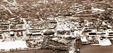
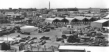
The first of these next three photographs was taken in 1968 of the centre of Doha and shows that about one hundred metres has been added to the shoreline at the north end of the suq. You can gauge the distance to some extent by comparing the relative positions of the graveyard – the large open space in the top right of the photograph above. At the north end of the wadi musheirib you can see, just left of centre, a large construction which was the offices of the Darwish Fakhroo family, one of the country’s major merchants. The beginning of the jetty development can be seen at the foot of the photograph.
The second photograph was taken a year later and is labelled as having been taken from the roof of the Finance and Petroleum building – originally known as Government House – in 1969. In the distance on the skyline the manara of the Grand Mosque can be seen and, to its right, the Diwan al Amiri, its north end being the blank wall with four openings in it in which, I understand, two similar residences were to be constructed. In the middle of the left edge of the photograph can be seen the Darwish headquarters building.
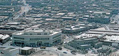
This third aerial oblique photograph, taken in October 1972, which looks south-east over the north end of the suq. The large office building in the left foreground is the Darwish Fakhroo main office with, I believe, a pumping station in front of it and, with its west end on the edge of the photograph, the recently constructed vegetable suq. In the right foreground is the central Police Station behind its security fence. Behind them is Doha’s main suq with the structures covering the internal sikaat clearly visible on the right.
With Doha’s road infrastructure starting, the first major new building was constructed by the government based on its need for offices to house the administration increasingly required to run the country. A number of smaller offices were built to house the new Ministers and their necessary operations, such as the Ministries of Education, Public Works and Electrity and Water, but a larger, central facility was perceived to be necessary.


Government House was built, I believe around 1967 or 1968, on the newly reclaimed land, north of the old corniche or littoral that runs behind it in this pair of photographs, apparently taken on the same run. Behind the old corniche can be seen the General Post Office, Ministry of Education and the Courts building to the right of Government House and, at the right edge of the photograph, the curved structural roof of the vegetable market. The first of these two photographs, looking approximately south-east, shows the shore a little to the east of the two photographs above it, as well as the end of the small jetty constructed to ease the moving of goods ashore from the dhows and straight into the suq behind it. The second photograph gives another view of this part of the centre of Doha with the east bay overlooked by feriq al-Salata and feriq al-Hitmi visible in the background.
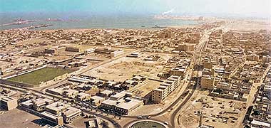
Said to have been taken in 1969, this aerial photograph looks over the east side of Doha towards its east bay. Smoke can be seen coming from the Power Station at Ras Abu Aboud just right of the centre at the top of the photograph. On the left, work on the port has started and much of feriq al-Salata can be seen to have been cleared top left. At the bottom centre of the photograph is the National Library with the road on the left running east to Ras Abu Aboud and, to the left, north past the National Sports Stadium.
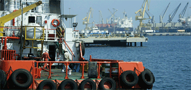
To contrast with the above photographs, here is one that gives some indication of the character of activity in the port in 2005. In the nineteen-seventies the port was only able to take four ships at a time and, with the amount of materials being brought in to feed the escalating economy, there were always ships out in the roads waiting their turn to berth. Now the port has been enlarged but the same pressure is on the port authorities to bring materials in and have them dispersed rapidly.
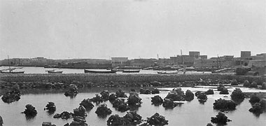
This photograph was taken in 1954 and is said to show the beginning of construction of the port with gabions forming the main structure and rocks being dumped to form the main structure. Looking carefully at the photograph it appears to have been taken from west and is of what was later known as the dhow jetty, the jetty which was established immediately north of suq waqf, Doha’s main suq. I believe the domes of Qassim bin Muhammad al Thani’s masjid can just be seen on the left of the photograph, though I admit that I can’t spot its manara. What is particularly notable is the shallow depth of the sea at this point, a reminder of the dredging that was to come about twenty years later.


The dhow jetty was crucial to the running of the country. Goods were brought ashore in Dukhan and Umm Said directly to their own small jetties, those goods relating to the oil industry but also including staples for those living and working there. But the majority of the country’s goods were carried into Doha from the dhow jetty either directly by dhows travelling from ports within and outside the Gulf, or by lighters used to tranship goods from, usually, ocean-going vessels that were too large to approach the shore – the waters near the shore in Doha being relatively shallow. It was not until the construction of the new port and the cutting of a deep water channel to it that this problem was overcome. In the first photograph, taken in 1954, the new jetty can be seen to have gates at its entrance with either a soldier or policeman on duty on the right. In the second photograph a dhow with its lateen sail up manoeuvres towards the jetty. The photograph was probably taken in the later 1950s or early 1960s.
One of the favourite forms of passive recreation in the early days of the State’s development, was the cinema. Mostly visited by expatriates, performances only took place at night as the first cinemas were roofless, a relatively inexpensive way of creating a cinema, though one that was affected by external noises, such as produced by aircraft, as well as creating noise for those living nearby.

This photograph of the cinema in Qatar Petroleum Company’s camp at Dukhan gives a good idea of what the larger ones looked like. In operation they worked well enough, following the usual pattern of advertisements, trailers and the main film, but with a break in the middle of the film in order for the audience to go out and buy refreshments from the stall outside. Expatriates, particularly women, were restricted to seats within an area cordoned off at the back. The cinemas in Doha were well used, though there was one notable problem, that of heat gain of the surrounding blockwork walls from the setting sun. This caused anybody sitting on the back row to feel uncomfortable, if not sick, from the low frequency radiation from the south or west facing wall.

The nineteen-seventies saw serious competition in the recreation market for cinema goers. Bearing in mind that cinema was and is an extremely popular operation in Egypt and the Indian sub-continent. The Gulf Cinema was constructed at Najma, directly feeding from the ‘C’ ring road, just off the bottom of this photograph which looks directly north. It is interesting to see how there was still much undeveloped land behind the cinema, that the tall blocks were relatively low by modern standards – restricted to six floors at that time – and that there was still a small farm operating.

There were a number of small buildings erected round the peninsula by the State but which were not really considered worth keeping as the population and wealth increased. Usually organised and designed as very simple structures they fulfilled a variety of basic functions relating to security and State operations on behalf of the public. This image is of a simple post office building, which would have been painted white and has a yellow post box outside. It fulfilled the needs of a local population, though I don’t know whereabouts this was photograph was taken. The image would date from the 1960s.

Around the peninsula there were a number of security structures, most of them operated by the police. This photograph, apparently made in 1941, shows a typical police post which usually consist of two elements – a ground floor for the office and accommodation, and a two storey tower to facilitate long views. Typically the structures are simply designed with small windows and high parapets with traditional maraazim and, particularly in the case of defensive structures, siqaataat.
The area around the Diwan al Amiri
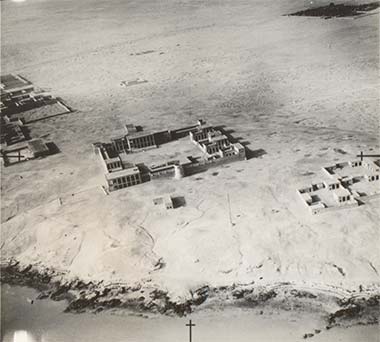
Prior to the Diwan al Amiri of the nineteen-sixties and seventies being constructed, there was a more traditional group of buildings sitting on its site. As mentioned below, Sheikh Abdullah bin Jassim moved from his site at feriq al-Salata to this location east of Doha around 1923, eight years after the Turks had left. I believe that this site was the one on which the Turks previously had a development as it was located in a significant position on the high ground that overlooks the centre of Doha and its suq and burgeoning harbour a little way to its east. As such it is likely that Sheikh Abdullah’s move here will have been a significant illustration of the ending of Ottoman influence.

The move may also have reflected the increasing amount of work required on the affairs of State as well as an opportunity to expand into a larger grouping or palace in an important strategic position. This photograph was taken in May 1935 with the complex in the centre of the photograph and the Sheikhs’ masjid centre left of the photograph. Note how the foreshore has yet to be developed.
The lower photograph is a detail of the first image above. It shows that there are two identical compounds on the right, west, of the development which may be accommodation for wives of the Ruler. The public functions of the Ruler are seen on the east and north sides of the development. There are rectangular defensive towers on the two corners of the south wall and a circular tower in the centre of the north, near wall, suggesting that it may once have been a corner tower prior to the development being extended.
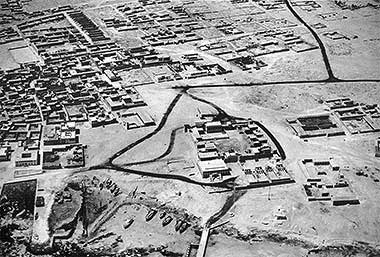
This second aerial photograph, said to have been taken in the early or mid-1940s and looking approximately south, can be compared directly with the photograph above. Sheikh Abdullah’s complex can be seen centre right with, centre left, the Sheikhs’ mosque and, to its left a development that was used both as a residence and majlis. Development to the south of the complex has started and the road to Rayyan leads out on the right edge of the photograph and the first of a number of residences for members of the al-Thani family developing a little way north of the Rayyan road, west of the complex. The north side of the complex has been extended and four equal compounds are in the process of being constructed, and it shows the foreshore with boats drawn up at its lower edge.

This small image is a blue dyeline photographic image taken, I believe, in 1952 and shows the development of Doha along the coast leading to the Diwan al-Amiri. At first I had thought it to be a map, but the image clearly shows the oiled or tarmac roads around the Diwan al-Amiri, suggesting it is an image from which mapping will have been carried out. It is interesting to compare it with the photograph above it.

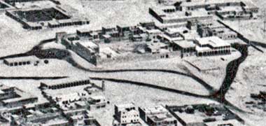
This photograph is a detail of the photograph two above and is the clearest image I have been able to make from it. Regrettably I am unable to state with any degree of certainty the use, or intended use, of each of the buildings though the large structure at bottom left is most likely to have been designated for formal offices and, perhaps, receptions. The traditional building top left may have been the main residence or, perhaps, the Ruler’s majlis. The most obvious provision appears to be the four similar buildings in the north-west – bottom right – of the photograph, and which would have been housing for four wives in compliance with the equality demanded by religious tradition. The access road from the Rayyan Road entering the compound from the west will have been made to maintain a degree of privacy to the family side of the development.
The lower of these two photographs is of the same subject and, I believe, taken around the same time. It is an enlargement of part of a larger photograph said to have been taken in 1952. The beginnings of the garden located on the south side between the compound and the Rayyan Road can be seen mid-left of the photograph.
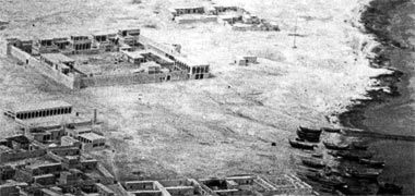
The next photograph is an earlier image of the same development, again seen from the east, with the Sheikh’s mosque bottom left, and the fourth photograph is a detail of the third in an attempt to show a little more detail. What is significant about the first and second pair of photographs is that there appear to have been a number of buildings in the mid-1940s photograph which have disappeared in the 1952 photograph. The lower photographs seem to accord with the photograph below, said to have been taken in 1945.

Notice, in the photographs – those immediately above and below – that the area around the complex is relatively free of buildings, perhaps a courtesy or requirement of those days when the ownership of land was of considerable importance to families or, alternatively, a requirement for distance from the location of the original Turkish fort on that site. However, with time, other compounds of close members of the al-Thani family grew along the Rayyan Road.


This photograph, incidentally, shows the old Sheikhs’ mosque on the right, viewed from the approximate north-west, and a building on the left used by the Royal family and, in the 1970s. Originally occupied as a majlis by Sheikh Hamad bin Abdullah al-Thani it subsequently was lived in by Sheikh Abdulaziz bin Hamad before becoming a residence for the British Advisor, Phillip Plant and his wife, Aziza.
In 1957 the development became the residence of Sheikh Mohammed Bin Abdulaziz al-Mana at the behest of the then Governor of Qatar, Sheikh Ali bin Abdullah al-Thani, being passed on to his son Sheikh Abdulaziz bin Ali al-Mana who used it as a majlis. In 1977 it was renovated and converted to become the Qatar National Development Exhibition building as well as the headquarters of the Arab Cities Award.
This aerial view of the Sheikhs’ masjid was taken in 1952 from, approximately, the south-south-west. I’m unsure, but I believe the large development to the south of it belonged to the Darwish family.
This coloured image was taken in 1953 looking approximately north-west and shows the manara of the Sheikhs’ majlis beyond which was Sheikh Abdullah’s compound. It is notable that the Sheikhs’ masjid and its manara were of a very simple design and construction, reflecting the simplicity of the wahhabi tenets held at that time by the sunni inhabitants of the peninsula.
In a relatively flat peninsula, the land on which the Diwan al Amiri is situated appears significantly higher than the land to its east, the area in which the suq was established along the wadi leading to the sea and with which Doha grew, mainly to the south and east. To the west of the raised ground was the historic urbanisation of al-Bida, itself situated on a continuation of the low scarp and the original capital of the peninsula.
There used to be a Turkish fort on the site of the Diwan al Amiri. The site is certainly a sensible one in terms of its strategic location as from there it would have been possible to monitor activities both in Doha to its east and Bida to its west, as well as movements on the track leading to Rayyan and Wajbah. The Turks had, in fact, landed at al-Bida in 1893 and Sheikh Jassim had responded by moving to al-Wajbah. So, establishing a stronghold on the Diwan al-Amiri position would have made strategic sense.
Movement by Sheikh Abdullah to this site may, therefore, have fulfilled two objectives – firstly a political one in removing a visually domineering reminder of Ottoman rule and, secondly, appropriation of its commanding position for his State and personal use. If this is correct, by extension the al-kuwt may have been retained for its use which was, during the Ottoman presence of 1872 to 1915, a fortified prison. It was also the location of a Bazaar Master who was responsible for the safety of the suq, providing armed guards by night.
For some time I have not been able to write about the character of the possible Turkish development on the Diwan al-Amiri site as I could find no records of it, nor have access to anybody who might know. Now, these two images have been developed from photographs taken by the German traveller, Hermann Burchardt in 1904 on his travels through the Gulf between December 1903 and March 1904.


The first image I understand to have been taken from fortifications on the site of the present Diwan al-Amiri and looks east from the higher ground over Doha. Traditional boats can be seen sitting out in the bay to the left, the photograph being taken looking approximately east. Note the tents on the right hand edge of the photograph.
The second image looks from low to high ground and is likely to be almost the reverse of the first photo. If this is so then the first photograph is likely to have been taken from the building in the background having a flag on it. The second photograph shows two people, one in Arab dress, the other probably a Turkish soldier by the shape of his hat. The orientation of the photograph is likely to be confirmed if the building to the right of the fortified structures is a masjid which would mean that the photograph was taken looking approximately north-west. Note the tents on the left hand edge of the photograph.
In the photograph, what became Doha’s West Bay is the sea with local craft on it to the left of the image, and Doha’s East Bay and open sea can be seen straight ahead on the skyline. The settlement of Doha is the main development behind the tower in the photograph. Sheikh Abdullah’s development at feriq al-Salata will be around a third the way across the skyline from the left of the photograph.
It appears that the image above is of a fortified, though ruined, development and would have been large enough to maintain a small garrison to complement the Ottoman troops garrisoned in al-kuwt in Doha or at al-Zubara. It occupies a significant high point between Doha and al-Bida. I am unsure, but it may be that this is the fort to which the Ottomans retired to following their retreat from defeat at the battle of al-Wajbah in the Spring of 1893. Qatari forces successfully besieged the fort, cutting off its water supply. Despite their shelling Doha, and being protected to some extent by the Ottomans’ corvette Merrikh on which were a number of Qatari hostages, the Ottomans surrendered. It is likely that the fort was then demolished by the victorious Qatari army.


Previously I had thought that the fortified wall and corner tower that exists at the south-easternmost part of the Diwan al-Amiri site, adjacent to the Rayyan Road, was this fort, but the first of these two photographs, taken from the side of the Sheikhs’ mosque, and looking north-west, shows the development on this corner of the site in 1945 and can be seen to be dissimilar from the above-mentioned forts. Of course, the corner tower might have been rebuilt.
The second photograph appears to have been taken some time later than the upper photograph, and shows a little more of the detail of the east wall, suggesting that it had been improved for prestige or for defensive purposes. The photograph is ascribed to Sheikh Ali bin Abdullah who ruled from August 1948 to October 1960.
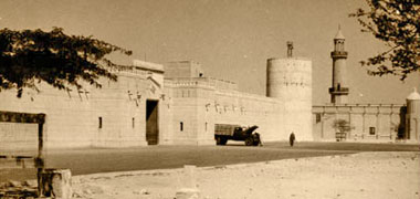


Compare the first two photographs above with the third and fourth photographs shown here. The first was taken in 1958, and shows a view looking north-east from the Rayyan Road with a fortified wall, large entrance gate and, now, a circular corner structure on the south-east corner of the Diwan al-Amiri development. The west side of the Sheikhs’ mosque can be seen beyond the corner tower, on the right, its mihrab right on the edge of the photograph. There is another photograph of this corner of the complex, below, taken two years earlier in 1956 when the burj Grand Mosque can be seen to be under construction. The central, colour, photograph was taken in March 1972 and looks across to the south entrance gate from the south-east. At this time the entrance to the Diwan was from the east while this entrance was used by the army guarding the site. The lowest of these three photographs places the Diwan al-Amiri in its urban setting in, I believe, the early 1980s. This Ministry of Information postcard was one of a number illustrating the progress that had been made in developing the country. The Grand mosque and Clock Tower are evident, and considerable growth has been achieved in the trees planted in the Diwan’s south garden. The Darwish site can still be seen with Qatar Cold Stores fronting onto the road, and before the site was taken over for the Ministry of Foreign Affairs.
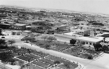
The aerial photograph shown immediately above was taken in the 1980s from an aircraft and looks over the Diwan al-Amiri towards the north. By contrast, this photograph dates from around 1967 and was taken from the top of the manara of the Ruler’s masjid looking south-west. A very similar image is shown further down the page.
The gardens of the Diwan al-Amiri have yet to grow into any substantial display though the design of the landscaping layout can be seen. The south entrance to the Diwan al-Amiri is just out of picture to the right of the photograph. The large villa on the right belonged to a member of the Royal family and the edge of the Fire Station can just be glimpsed on the left of the photograph. It appears to have been under construction at the time of the photograph.
In the centre of the photograph, set at 45° to the junction of the Rayyan and Abdulla bin Thani roads, is the entrance to the Doha palace of Sheikh Suhaim bin Hamad al-Thani who served as Foreign Minister under his older brother, Sheikh Khalifa, who became the Ruler in 1972. To the left or south of the entrance is the tall, but two-storey structure of the Ali bin Ali supermarket in front of which the road led south to the Abdullah bin Thani roundabout and its masjid, continuing south to the Doha Palace hotel and west to what was known to expatriates as Bread Shop street which itself led to a junction with Electricity Street where Darwish’s upmarket two-storey Modern Home store was located.

This photograph has been included here for three reasons. Firstly, it shows a group of companions of Sheikh Abdullah bin Qassim al-Thani, the Governor of Doha from 1906, the date of the death of his father, and who became the Ruler of Qatar in 1916, abdicating in 1949. These were a group of trusted men who customarily accompanied him, acting as his aides, bodyguards or helpers. Interestingly, the word describing them, lakhoya, is a local Gulf word that is now used for a special branch of the police force.
The second reason is that the photograph illustrates what is apparently an important doorway. It appears to be the door that can be seen in the centre of the middle of the three photographs above. It is noticeably of a scale that is grander than the old residential development of Sheikh Abdullah bin Qassim al-Thani at feriq al-Salata, later to be developed as Qatar National Museum. My guess would be that this entrance leads to the more private parts of the development, the north end containing the more public or State elements.
Despite its apparent importance the decoration around the doorway is unusual in that it seems very much understated compared with some of the work that went before it as well as later. It is not possible to read the central panel but it is likely to be headed by a religious statement and incorporate information about the building. The steps indicate that it is intended as a pedestrian entrance with no vehicular access, and the door and frame are very heavy timber elements designed in the traditional manner.

In 1956, it was evident that there was quite a lot of the construction in Doha concentrated around the Diwan al Amiri in an attempt to consolidate this important development with the newly designed road system. Here you can see both the mosque under construction on the right with the Rayyan Road between it and the Diwan al Amiri on the left, the Rayyan Road leading left out of picture. This view looking north shows the Rayyan Road leading west and, straight ahead, turning east past the mosque and entering the Clock Tower roundabout, just out of sight behind the mosque.

Above, in the first photograph in this area, there is a masjid on the road that leads from the end of the Rayyan Road diagonally towards the left of the photo as well as leading on to the central Doha suq. This masjid was known as the ‘Sheikhs’ mosque’, as I imagine it was associated with the members of the Royal Family making their homes in the area to the south and west of Sheikh Abdullah’s complex. This photograph was taken of it in 1946, immediately after the Second World War. The photograph looks north-east over the sahn of the masjid towards what later became known as the Ruler’s jetty. Note the relative simplicity of the architecture which appears to reflect the wahhabi character of the peninsula.
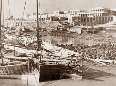
Sitting on its prominent rocky outcrop west of the main suq, and mid-way between the suq and the old village of al Bida, this photograph was taken from the north-east, looking from the Ruler’s jetty. The photograph is said to have been taken in 1950 and shows a relatively traditional development, though one that was larger than anything else in the State at that time. You can see both in this photograph and those below it that, although there is a rock jetty perhaps intended to give access to slightly deeper water, boats were being drawn up onto the foreshore behind it.


Here are a number of slightly different views of the development on the Diwan al Amiri site, this time taken in 1954 and 1955. The first two photographs were taken in 1954 and show the northern part of the development looking, on the first photograph almost due west and, in the second photograph north-west from a slightly closer and higher viewpoint. On close inspection of the photographs, they appear to show the buildings as being recently completed though the land around it has not been finished other than having been levelled through immediately adjacent to the buildings. There seem to be no people in and around the development as might be anticipated for buildings relating to the head of State, which suggests that it might not yet have been occupied in its entirety.
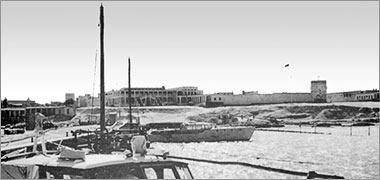

These two photographs were taken a year later, in 1955, and show a little more of the development, the first looking towards it just west of south. The towers of the eastern fortified wall can be seen on the left of the photograph, but there is also what appears to be a square tower on the right or west side of the development. I am not able to say if this was there before Sheikh Abdullah removed to the site, or if this was constructed after his arrival. But there is also more development to its west which suggests that the tower was there first and the western development was added later when there was perceived to be no further need for a defensive structure. The second photograph is labelled as being also 1955, and states that it records the return of Sheikh Ali bin Abdullah al Thani, though where from is not stated.


These two photographs, of a group of four, appear to have been taken around the same time and I had at first thought them to be the same image; close inspection suggests they are not. I also thought they may have been taken seconds apart but the shadows suggest that the first was taken in the morning, the second in the afternoon. The first photograph with its wider view gives a little better context of Sheikh Ali’s complex on its promontory, and its relationship with the sea. The lower of these two views of Sheikh Ali’s complex comes from a 2003 competition document stating the photograph was taken in 1947. If compared with the aerial photo above, which is known to have been taken in 1947, this can be seen to be an error. I believe it was taken around 1956 and shows the whole of this important grouping with the palace complex on the right and land I believe belonging to the Darwish merchant family on the left. The jetty, later known as the Ruler’s jetty is cut by the bottom of the photograph. The Sheikhs’ mosque can be seen as can the Clock Tower. The covering of the boats suggests that the photographs were taken in the hotter period of the year.

Taken in the late 1950s, probably from a vantage point on the Ruler’s mosque, this photograph looks north over the same area as that in the two aerial photographs above, but towards the bay with the Clock Tower in the foreground. While the construction of and around the Clock Tower appears to be complete, it can be seen that the landscaping was yet to be established. The Ruler’s jetty can be seen in the top left hand corner, and the land belonging to the Darwish family is on the right and behind the Clock Tower, divided by Abdullah bin Jassim road aligning east-west. On the north side of the road is Darwish’s Qatar Cold Stores.
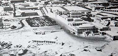
This photograph is also said to have been taken in 1958 though I believe it more likely to have been 1956 and may even be a detail of the photograph two above. It is included as although it seems to have been taken from a similar perspective, it was taken in the morning and is a little clearer than the photograph immediately above which was photographed in the afternoon. The Clock Tower can be glimpsed on the left edge of the photograph.

This photograph is a detail of the photograph above and shows the double staircase entrance to the Diwan, a feature of the Municipality building constructed a little later. At the far, south, side of the complex there are watchtowers or fortified towers incorporated into a protective wall which can be seen in some of the photographs lower down the page. The beginning of the Rayyan Road can be seen turning round the south-east corner of the complex before heading directly west, right, to Rayyan.


As can be seen from the date superimposed on this photograph, it appears that the image was captured in 1957. I had been led to believe that the photograph three images below was also taken in 1957 but, assuming that the date on this photograph is correct, I have suggested that the photograph below was taken at least a year later. However, the government has dated the image above as 1956 and it is entirely possible that both that photograph and this were taken on the same run, and certainly only a short time prior to the two photographs that follow the second of these two images.
This second photograph appears to have been taken from a similar angle and height as the preceding image, but is important in showing the wider context of the area to the east and south of the Diwan al-Amiri. My understanding from the video from which this image was made is that it was taken in the 1950s; the image appears to have been taken a little after that above. It illustrates the Darwish Cold Stores and, to its east, the adjacent masjid on the right edge of the photograph, as well as something of the extent of ground won from the sea between the old road and the new Corniche, out of picture right.

This photograph, taken looking approximately north-west from the roof of the British Policital Agency building, shows the Diwan al-Amiri under construction beyond the Clock Tower which, to all intents and purposes is completed. The dating on many of these photographs is problematic, but the sequence appear to have been taken in the late 1950s. The construction of the Diwan al-Amiri was of massed in-situ reinforced concrete walls with concrete floors and roof. It was an extremely solid construction but a relatively simple plan. Rooms at first floor level were arranged around an internal courtyard with a colonnaded access on both the outside and inside walls, both of which can be seen in the photograph below. There were a number of rooms on the ground floor intended for state functions including two large spaces for a majlis and a dining room. The single story development on the right of the photograph belonged to the Darwish family and was developed into a two storey building housing the Darwish Travel Agency.
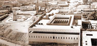
The date given to this photograph is 1957 though, if the date above is correct, then this is likely to have been taken a year or two later, perhaps 1958 or 1959 due to the amount of work entailed in constructing the new building of reinforced concrete. It shows a number of interesting things happening to and around the area of the Diwan al-Amiri. At the top of the photograph, the Grand Mosque is being demolished, its manara still standing. On the left, east, the Clock Tower and its roundabout have been completed and in use and the Diwan al-Amiri itself is under construction. The external walls of the Diwan have been completed but the internal partitioning has yet to be added as can be seen through its arcaded façade, and the run of rooms on the first floor of the west side has not yet been constructed. The bottom right hand corner of the photograph shows part of the extended element of the development which was never completed and was demolished when the new Diwan al-Amiri was constructed to the west of the existing Diwan al-Amiri. The bottom left corner of this photograph just touches the existing shore line, the external works to the east of the Diwan appear to be in progress as is internal construction to its west. There is another photograph lower down the page illustrating this area, probably taken earlier in the same year.
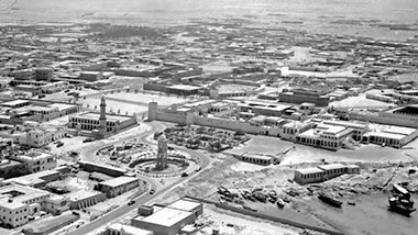
This aerial photograph shows the development around the Diwan al-Amiri, probably around 1956, as seems to have been the case with the photographs two paragraphs above. In fact it may have been taken from the same photographic run and has a wider area of view than that two photographs above. It shows clearly the old development of the Diwan al-Amiri, the old ‘Sheikhs’ masjid’ and the Clock Tower. The old hospital is in the bottom left hand corner, and some of the Darwish family holdings are around it to its west and opposite, Darwish Cold Stores being the buildings almost in the centre of the bottom of the photograph. Their small masjid can just be seen on the bottom edge. Country craft are pulled up on the foreshore, as yet undeveloped and adjacent to what was known as the Ruler’s jetty where there was a policing presence. The limited extent of Doha to the south-west is clearly seen towards the top of the photograph.


In the first of these three photographs, the complex is seen two years later in 1960, this time from the south-west. The west wall of the fort can clearly be seen along with three of its fortified corner towers. The main entrance gate is from the south which leads into the first courtyard. It is difficult to make out but the next courtyard has a number of more traditional buildings constructed around it. The Ruler’s jetty is more prominent than it would become when land was reclaimed and the Corniche driven between it and the Diwan al-Amiri site. The Clock Tower can be seen as can, right on the edge of the photograph, the manara of the Sheikhs’ mosque.
The second of these three photographs shows a little of the development of the south-east corner of the first courtyard, though the photograph appears to date from the nineteen-seventies by the look of the Grand Mosque.
The third photograph, apparently taken from the manara of the Grand Mosque, looks straight into the south-east corner of the southern courtyard of the Diwan al-Amiri or, perhaps more accurately, into the courtyard of Sheikh Abdullah’s development of the site. Note the traditional buildings, centre right, that are located within the inner courtyard of this development. The corner of the first Diwan al-Amiri can be glimpsed on the right edge of the photograph.

This photograph, a government postcard, shows the Diwan al-Amiri looking approximately north-east in 1966. The manara of the older Grand Mosque can be seen to the right with the top of the Clock Tower to its left. The gardens of what was to be the south and main entrance to the Diwan al-Amiri have not been started and the surrounding fence is still under construction. In the foreground is a row of single storey buildings which, I believe, were taken down and two-storey constructions erected in their place incorporating police and fire brigade facilities. The Rayyan Road moves out of picture to the left.

This photograph illustrates almost the opposite view from that above. It appears to have been taken from the top of the manara of the Grand Mosque looking south-west and shows the east end of the Rayyan Road, south of the Diwan al-Amiri. I believe the photograph would have been taken around 1970. The south gardens of the Diwan al-Amiri are seen on the right, and the buildings on the left were the central Police and Fire Brigade Stations separated from the Rayyan Road by parking. The building in the centre of the photograph is that of Ali bin Ali which also housed their cold store supermarket, popular with expatriates and in competition with Darwish Cold Stores east of the Diwan al-Amiri. To the right of this building is the entrance to the Doha palace of Sheikh Suhaim bin Hamad Al-Thani, uncle of the Sheikh Khjalifa bin Hamad al-Thani, with a mass of trees in its courtyard.


This pair of photographs were taken at around the beginning of the 1970s when the Diwan al-Amiri became the offices of the new Ruler, Sheikh Khalifa bin Hamad al-Thani. The first photograph has the Clock Tower on the right and the Municipality office at left centre. The buildings in the centre foreground belonged to the Darwish family and between them and the Municipality building was a small psychiatric and orthopaedic hospital.
This photograph was probably taken in 1973 and shows that the Diwan al-Amiri was by then in operation. The foreground was a shared parking area where the staff of the building and ordinary visitors having business in the Diwan parked their cars. Dignitaries were able to drive their cars up the ramp to the right and into the north courtyard of the building.
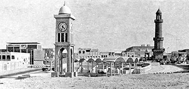
Compare the photograph above, looking south from the Diwan al-Amiri car park in 1973, with this photograph, taken from around the same position but ten years earlier, in 1963. The obvious differences are that the ground is still being prepared in front of the Diwan, the Darwish family have taken down their building and erected a two storey office building which housed Darwish Travel, and the Sheikhs’ Mosque has been reconstructed. You may notice that the proportions of the two towers are different. The 1973 version looks to be the more accurate but I have not amended the photograph to reflect this, but left it as I found it.

Between the above two images, this photograph looks over the Clock Tower roundabout towards the entrance to the Diwan al-Amiri. It can be seen that the windows to the Diwan al-Amiri have yet to be installed, and that the car parking in front of it has been prepared but apparently not finished as the building was yet to be occupied. The Clock Tower roundabout had a well-trimmed hedge around its left, southern side. Later this was taken down and a metal and concrete balustrade installed.


This next group of photographs appear to have been taken relatively recently but are of a similar date to those above and expand the information of the Diwan al-Amiri from that time. This first photograph looks over the area being prepared immediately east of the Diwan al-Amiri and intended to provide a parking area for the staff working there and visitors. The Clock Tower is evident with the Darwish company’s offices, known as ‘Darwish Travel’ behind it. On the left of the photograph is more of Darwish’s land with their ‘Qatar Cold Stores’ and a masjid which I believe they constructed behind it. The lower photograph is a more detailed view of this complex. The Darwish properties extended to the Corniche, left out of picture. The white building just to the right of the burj of the masjid is the Municipality building.
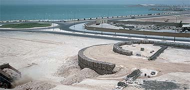
Looking north-east from the Diwan al-Amiri, this photograph shows work proceeding on the construction of the retaining wall elements of the parking area, the design being apparently based on the half-moon battery in Edinburgh. Gabions can be seen to be in place and a lorry from the Taxi Association is tipping fill to the required profiles. In the event, although the design was complete, the ramps were not used, staff moving onto the parking area directly from the Clock Tower roundabout. The north end of the Darwish land can be seen on the other side of the road linking the Clock Tower to the Corniche.

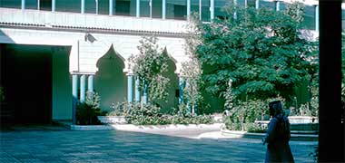
Taken two years later in October 1975, this photograph shows the raised main entrance to the Diwan al-Amiri, facing east. Parking for staff and visitors was on the area to the right of the photograph, behind the balustrade; only the Ruler, ministers, diplomats and distinguished visitors were permitted to be driven into the internal courtyard, guards being positioned at the top of the ramp, below the entrance canopy with the security office and its personnel immediately to the right within the entrance. Access to this courtyard could also be obtained from the west, but only by passing through the south entrance gates and a second gate facing the main entrance, shown in the second photograph which was taken facing approximately north-west. Essentially this was used only for servicing.
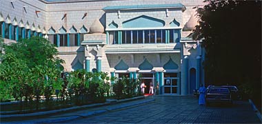

The Diwan al-Amiri was originally designed in the days before it was thought that air-conditioning should be a necessary consideration. Its plan form was simple in that it was conceived as a row of rooms having access from wide arcaded corridors both sides of it – both looking onto the courtyard and to the outside of the building. This would have provided shade to the rooms which were fitted originally with ceiling fans. In the event, when leadership changed in 1972 and the decision was taken to move the seat of government into the Diwan from Government House, the arcading was glazed in with, on the outside of the building, the corridor being incorporated into the rooms and, on the inner, courtyard side, the corridors being retained for access.
The first of the two colour photographs above, taken within the courtyard, shows the main entrance from the courtyard into the building with the façade glazed in at first floor level. It was also enclosed at ground level at this north end of the north courtyard, though this wasn’t the case in the south courtyard which was not incorporate important offices as surrounded the north courtyard. In the lower photograph, the eastern internal corridor, looking north, can be seen, this being replicated at first floor level, though that internal circulation corridor was enclosed by glazing in the 1970s development.
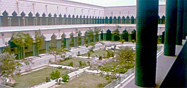
This photograph, taken in 1965, can be compared with that just above. It illustrates the central courtyard of the Diwan prior to it being developed as the offices for the Head of State at the beginning of the 1970s. Note the architectural treatment at the north of the courtyard. This was altered to reinforce its importance as the entrance to the offices by the heavy styling seen above. Just inside the entrance was a grand staircase on the left, and a lift was located on the east side of the entrance space. Black and white images of the entrance façade are added below.

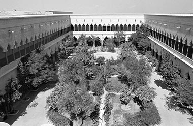
These two black and white photographs were taken a year earlier, in 1971 when the building was in the process of being developed for occupation by the then Ruler, Sheikh Ahmed bin Ali al-Thani. At that stage of the development the planning of the rooms at first floor level had been relatively simple, with most of them being intended as bedrooms, each having a bathroom en suite. On the ground floor were larger rooms for meeting the public, including a significantly sized majlis at the north end and dining room on the west side of the development.
Comparing these first two black and white images with those coloured above it can be seen that in 1971 there was no glazing yet between the columns at first floor level. Although the sun is shining on the opposite face of the courtyard, these views both look towards the south, the first one being taken from a position on the first floor with the photographer’s back to the main staircase above the main entrance, and the second has been taken from the roof directly above, both looking into the courtyard of the building. The main entrance to the courtyard was from the south-east at the far left end of the courtyard, obscured in this photograph by the planting.

This third view, of the west side of the courtyard, was also taken inside the Diwan al-Amiri and, looking at the height of the planting and comparing it with the images above, the photograph probably dates from the mid-1960s. The image is interesting for a number of reasons.
Firstly, the lack of glazing on the inside of the courtyard at first floor level can be clearly seen. With the later enclosure created by glazing between the columns, it was possible to provide air-conditioning to the interior. Immediately behind the columns there was a wide corridor serving offices on the west side of the building. It is also notable that the ground floor ceiling height was significant in order to accommodate the very large majlis and dining room.
The central feature of the Diwan’s courtyard – a landscaped water feature – was originally protected by a metal screen which was taken down in the 1970s providing a more interesting central space. Whether this created a significant environmental difference to the internal courtyard was debatable but, with the large opening provided for vehicular entrance on the east side of the courtyard, there was air movement within the courtyard, a fountain providing an aural benefit if not an environmental one.
The three individuals in the photograph are likely to be some of the badu guards who accompanied the Ruler to the Diwan, spending their time around the courtyard or corridors along with other security represedntatives.

These two images were made from an old video taken some time in the 1960s and are placed here to illustrate something of the history of the surrounds to the Diwan al-Amiri. This first image shows the large gates at the south end of the internal courtyard open, something I never saw in the seventies or eighties. When the Ruler was not in the Diwan it was possible to service the building from the main entrance facing east, but normally servicing was carried out with access to the building from the south entrance through the gardens to the left out of picture, then into the main courtyard through large gates facing the main entrance. To the right is the mihrab of the Sheikhs’ masjid with some construction material by the side of the road. The masjid was under construction in the early 1960s – two men can be seen working on the roof of the mihrab – suggesting the video was made prior to 1965 as, further down the page there is an image of it taken in 1963.

This view of the east-facing main entrance to the Diwan al-Amiri was taken from Sheikh Abdullah bin Jassim Street a little way east of the front of the baladiya or Municipality building whose west wing can be seen as the arches on the left of the image with the Clock Tower behind it. The masjid on the right is the simple traditionally designed Darwish masjid with, behind it, Qatar Cold Stores, one of the two main stores selling foodstuffs chiefly to expatriates. Its rival was Ali bin Ali Cold stores situated adjacent to Sheikh Suhaim’s development on the junction of the Rayyan Road and Abdullah bin Thani Street. To the right of this image is open land on which a number of banks were constructed in the next two decades. A later view of the Diwan al-Amiri along Abdullah bin Jassim Street, and from further east, can be seen further up this page.
This next group of photographs puts together some old images relating to an important historical site and building which formed a part of the visual urban enclosure of the area in front of the Sheikhs’ masjid and Sheikh Abdullah’s complex to the west and south-west respectively. Its importance lies in that it was the building used to house the British Political Agency in Doha occupying a site on the east side of the area, facing west over the site where the Clock Tower was to be located a few years later.

Known as the wadi site, the first of these images, dated to 1954, looks directly north from its position adjacent to the West Bay, Sheikh Abdullah’s complex being situated on the higher ground south-west of this site.
Offered in 1950 to the British for the construction of a Political Agency by the Ruler, Sheikh Ahmed bin Ali al-Thani, and known by them as the ‘wadi’ site, it was deemed too small for their purposes and no building was constructed there. The buildings to the right or east belonged to the Darwish family.

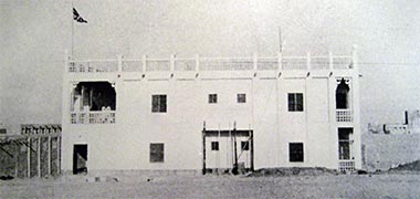

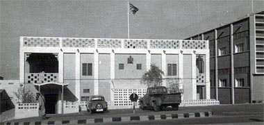

With political and administrative pressure on them to develop a proper footing in Doha, the British instead leased a two-storey building on the higher ground south-east of the wadi site in 1954. Known by them as the ‘Sheikh Ahmed’ building, it served their purposes for a small number of years and is illustrated in the image above and the next four photographs which appear to be in the correct date order.
The first two photographs of the building above were probably taken in 1954, and look approximately north-east and east respectively. They may even have been taken around the same time as they show piles of material outside, suggesting work in progress. This is supported by the second and third photographs showing the installation of two drains and, probably, water pipes from first floor level toilets into the ground. The third photograph looks as if it was taken some time later, perhaps even with a new building constructed to its south side.
This fourth photograph was obviously taken some time later as there is a surfaced road with a raised pavement with striped kerb. I believe it was taken in 1963. The area below the first floor toilets has been enclosed with ventilation provided and a new entrance with cover has been provided at the left, north entrance.
This architecture of the 1950s and 1960s has resonances with Sheikh Abdullah’s residence at feriq al-Salata in its trabeated construction as well as its plan form of central rooms with surrounding verandah – although the Political Agency had a small central courtyard which can be seen in the coloured image. Note the maraazim and the small features in the junction between beam and columns, adopted from the local design vernacular. I have written elsewhere that they seem to be referred to as muqarnasaat, but am unsure if this is correct.
The fifth, coloured, photograph is of the same building, looking down on it from the top of the manara of the Grand Mosque in 1972, the British Political Agency having left the site in 1964. It shows that little has changed on the façade in the intervening years other than its by then being in use by the Qatar Government. The building to its right, or south, was used by the Ministry of Labour and Social Affairs.
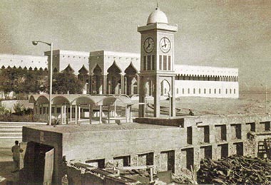
By 1963, the view from the British Political Agency had changed with the design and building of the Clock Tower to its west some five or six years previously, and the continuing development of Sheikh Abdullah’s compound to its north-west with its grand entrance and ogee arches. This photograph, looking north-west shows these structures with, in the foreground, the south-west corner of a compound belonging to the Darwish merchant family – see also, the photograph two below. It was on this corner that they developed a two-storey commercial building incorporating the offices of Darwish Travel, one of the first if not the first travel agency in Doha.

In order to give some idea of the context of the Political Agency building, this photograph shows the south-east corner of the important grouping of buildings in 1958, comprising Sheikh Abdullah’s complex on the west, the Sheikhs’ mosque and Sheikh Hamad’s majlis on the south, and the Political Agency on the east. The Clock Tower can be seen in the foreground with the manara of the Sheikhs’ mosque top right. Sheikh Hamad’s majlis is the white building directly above the Clock Tower, and the Agency building is on the left of the photograph, the east side of the area. Incidentally, note that the ruwaaq or iwaan of the mosque is two-storied.
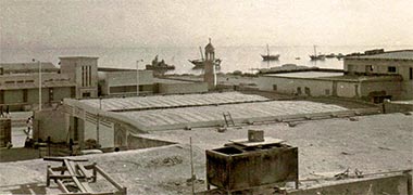

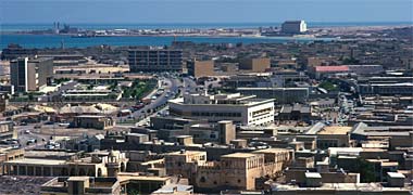
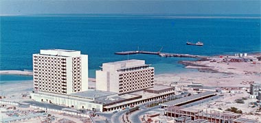
This first photograph was probably taken around the nineteen sixties or even seventies, as there are street lights in evidence. It is a view from the British Political Agency building north towards the West Bay of Doha over a storage area belonging to the Darwish family. The building on the other side of the road and on the left of the photograph was, or became, Qatar Cold Stores, a retail outlet for groceries. On the right is the manara of a small mosque which I believe was constructed by the Darwish family. All that area was eventually taken by the government in order to construct the Ministry of Foreign Affairs in the nineteen seventies. The dhows are standing off what was known as the dhow jetty the end of which can just be seen.
The second photograph was taken from a similar angle, looking north-east, but from the manara of the Grand Mosque. Qatar Cold Stores and the small mosque can be seen in the lower left corner of the photograph, taken in 1972.
The third photograph, taken at the same time as that above, looks over the suq towards the Gulf Hotel in the distance with Ras Abu Aboud power station chimneys visible against the horizon top left. The Darwish Fakhroo offices are in the centre of the photograph and Government House is on the left edge.
The last of these photographs is an aerial view looking approximately north-east down on the newly developed Gulf Hotel, at that time the premier hotel in Qatar where previously this had been the Oasis Hotel a few hundred yards to the west of the Gulf Hotel.
The nineteen-forties saw the construction in Doha of the first State hospital, the initiative for developing medical care in the State being taken by Sheikh Hamad bin Abdullah al Thani. The building was situated close to the sea for health reasons, and to the east of the Darwish compound that was located next to the Clock roundabout, itself east of the Diwan al-Amiri. The roof of the hospital can be seen on the right of the photograph above.


In the first of these next three photographs the hospital is seen under construction in 1945. This is the same building that is shown on the bottom left edge of the second photograph, taken in 1957, opposite the small masjid. The first photograph illustrates how close the sea was from the rising ground leading up to the Diwan al-Amiri at that time, and before it was land-filled for later development. I believe that the sea was filled to a distance of one hundred yards from existing land ownerships, but that the government acquired the right to drive a road along the line of the former shoreline – the road in the second photograph running between the hospital and the small masjid. There was also a small road between the hospital and the Darwish land to its west. The bund or jetty from which the first photograph was taken would have been out of picture at the bottom of the second photograph, a little way to the east of the masjid. Comparison of the two photographs illustrates the process of land reclamation over the twelve year period, the process later continuing westwards to reclaim land north of the Diwan al-Amiri site and, later still, the Corniche being driven along the edge of the West Bay to establish a ceremonial thoroughfare while creating a hygienic and clear edge to the littoral.
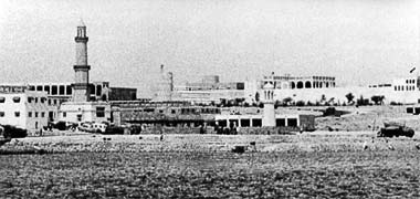
This third photograph was taken looking approximately south-west, and appears to have been made after the construction of the small masjid which can be seen in the foreground just right of centre, but before Qatar Cold Stores was built behind it, which would place it some time before 1957. The hospital can be seen on the left of the photograph in front of the manara of the Grand mosque.
The hospital is said to have begun as a single storey building, though the photograph of it above appears to show its construction as two storeys, built around an internal courtyard. At a later date there were extensions made to it under the auspices of Sheikh Ali bin Abdullah al-Thani, particularly on its north-east corner where operating rooms and other facilities were constructed. Designed to be a general purpose hospital it had thirty rooms and was the place where many mothers gave birth to their children, easing the problems associated with home births.
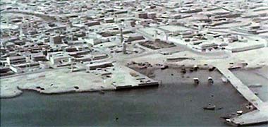
This aerial photograph, taken approximately from the north-east, appears to have been made in the early or mid-1960s and can be compared directly with the image two above. The filled land with Darwish Cold Stores, a storage area and a mosque on it can be seen in the centre of the photograph as can the Ruler’s jetty in the right bottom corner of the photograph, where police craft were moored.

Taken in the same year as that above, this view is of the southern wall of the Diwan al-Amiri complex, looking north-east and taken from the south side of the Rayyan Road which led west to Rayyan. To the right is the manara of the Ruler’s masjid and, between them can be seen the top of the Clock Tower. In front of the entrance to the Diwan a garden was later developed, but this entrance was not used for long, the main entrance being developed on the eastern-facing side of the complex.
The nineteen-fifties saw the development of a much larger hospital, illustrated on the next page, at Rumaillah bringing with it a wider range of capabilities. The old hospital was given over first to the isolation of chronic and infectious diseases and, by the early nineteen-seventies, to long-term care for orthopaedic and psychiatric patients.

This first of these four photographs is of the Sheikhs’ or Ruler’s mosque and is said to have been taken in 1957, probably early in the year, looking west and showing the jum’amasjid for Sheikh Ali being constructed. Known as the Sheikhs’ mosque, the photograph is also interesting for the numbers of people around. It is difficult to make out what they are doing, but I assume it has to do with construction works around the Clock Tower. Note that this appears to be a rebuilding of an earlier manara as it can be compared with the photograph above which shows a much simpler structure.
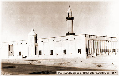
The second photograph shows what appears to be the completed building, this time viewed from the south-west, the Rayyan Road visible as it skirts the mosque before straightening out to run west towards Rayyan. The south-east corner of Sheikh Abdullah’s complex would be immediately to the left of this photograph. Note the vertically ribbed decoration to the top of the mihrab and its flat dome capping, similar in design to that which caps the top of the entrance porch on the east side of the building.
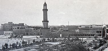
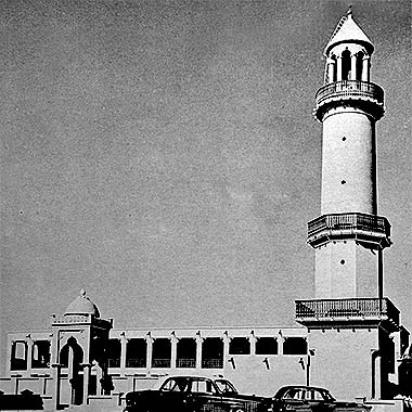
This next photograph is a view of the Sheikhs’ mosque, stated to have been taken in 1956, apparently from the first floor of Sheikh Ali’s complex. It appears that this and the two photographs above it need to be reversed in date, or at least in order. The area between the mosque and the Ruler’s complex can be seen to have been given some degree of design organisation with a small garden having been laid out and planted. The area in front of the majlis on the left has been given over to car parking at a time when there would not have been many cars on the roads.
The fourth photograph of the Sheikhs’ mosque is dated 1958 and shows the final form of the manara, this being at least the second on the site. Interestingly the manara rises from a square base to an octagonal middle section on which a circular drum rises to a circular balustrading above which a conical cap is held on top of eight semi-circular headed arches supported by circular columns with, apparently, small capitals. The ruwaaq of the mosque has a very traditional and simple arrangement with projecting maraazim. The entrance porch seems slightly out of character with its elongated arch arrangements.
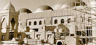
But it wasn’t many years before a new, larger mosque was required. Whether this reflected the increasing population it was now required to serve, or the need to produce a more modern design in keeping with the new Diwan al Amiri and Clock Tower development, is difficult to say, though the rationale is most likely to have had something to do with both. This photograph, taken in 1963, shows the body of the Grand mosque being constructed as a redevelopment of the Sheikhs’ mosque. Note that the older entrance porch has been retained, and that it has a design resemblance to the Clock Tower. This latter seems to have been constructed around the same time as the entrance porch to the Sheikhs’ mosque.

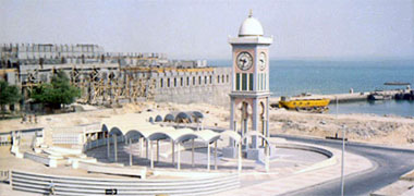
This photograph of the Diwan complex was said to have been taken in 1957, probably from the Darwish offices that were on that corner of the Clock Tower roundabout, but appears to be later than the 1958 photos shown above as witnessed by the growth of the ficus trees in the garden. If you compare Sheikh Ali’s complex on the left of the photograph, taken from the south-east, with the sepia photograph five photographs above it, you will see that some of the older development has been taken down and there are the beginnings of a heavy concrete structure being raised which will have been the foundations for an extension to the Ruler’s compound, the first Diwan al-Amiri. I don’t know when the coloured photograph was taken, but it shows that construction has progressed on the northern most part of the development and, I believe, that the southern part of the old complex is also being developed.
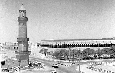

This photograph is likely to have been taken from the roof of the old Political Agency building to the south-east of the Clock Tower roundabout, the angle being around 90° anti-clockwise from the image above, and looking just north of west. The photograph is said to have been taken in the 1950s, and appears to have been taken around the end of the decade. The southern end of the main Diwan al-Amiri building being mostly complete and decorated. Although the arcading is in place, it was some time before offices were created in this wing of the building.
Taken in 1958, this is the view south-west across the Clock Tower roundabout. The old Sheikhs’ mosque and its burj have yet to be replaced by the more modern development. What is evident in the photograph is the double storey height of the iwan. The tall, domed entrance canopy is a notable feature of the east side of the development, a similar design, seen above, being used in the new development.

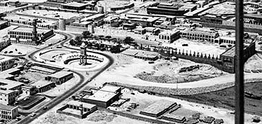
This next pair of photographs are interesting in that they were taken from approximately the same aerial position, though with a number of years between them. Appearing to have been taken prior to those above, although included with a group of photographs taken in the 1970s, these two aerial photograph gives a better idea of how the Diwan al-Amiri compound was developed in the late 1950s. The old Sheikh’s mosque, which was still there in 1958, remains in place and the construction of the expanded, reinforced concrete Diwan al-Amiri is underway. The fortified element of the original compound to the south of the Diwan development remains, the two southern corner towers being incorporated into the new development. Preparation for a road leading from the Clock roundabout to the sea and then the north has been constructed and the boats removed from the foreshore to be replaced later by a small jetty known as the Ruler’s jetty. The vertical bar on the right of the lower of the two photographs, is part of the over-flying aircraft.

Although this photograph is out of date order – as are many of the photographs on this page, regrettably – it has been included as it shows the situation with the Diwan al-Ammiri grouping in 1969. The Sheikhs’ mosque has been rebuilt and is in its present form and, at the top of the photograph, the Ruler’s jetty can be seen. The Diwan car parking and half-moon battery landscaping can be seen in front of the Diwan and, across the road to the sea, the Darwish land with its storage buildings can be seen with the Darwish Travel offices right centre of the photograph.

This photograph should be read along with those above and below it. By 1962, when the photo was taken, the decision had been made to develop a different type of building at this point of the bay. This position located it between the settlements of Doha and al Bida, four hundred metres to the west of Doha, according to the British Admiralty’s 1864 Persian Gulf Pilot. The building type was extremely large compared with anything that had gone before it. Although it had a similar footprint to the building that preceded it – that being a large complex in itself – its style was significantly different as can be seen by comparing this photograph with those above. Constructed of concrete and with a definite influence from the Indian sub-continent it created a strong focus, its main entrance facing east over Doha. There are a number of interesting details in the photograph. There is considerable landfill taking place in order to produce what became the parking area for the Diwan al Amiri, the Clock Tower is completed, though its surrounding colonnade appears not to be, and the Grand mosque is under construction, the tower having been completed. The land on the left, east, of the photograph, belonged to one of the main merchants and the lighters show how goods were brought in from the ships standing out in the deeper water of the bay. Incidentally, it can be seen that the traffic drives on the right. I’m not sure when the change from driving on the left took place but it is likely to have been before 1962.
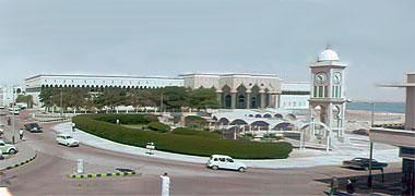
Taken in the middle of the mid-sixties, this first image looks north-west across the Clock Tower roundabout towards the Diwan al-Amiri. Development of the external works to the Diwan al-Amiri can be seen behind the Clock Tower, but this work went through a number of treatments as its importance with regard to security, the need for parking and landscaping changed over time. The building on the right edge of the photograph housed the offices of Darwish Travel.
The second photograph was taken looking out of the Darwish Travel offices towards the Grand Mosque showing a little of the small car park to its east as well as a hint of the slope of the roundabout. I can’t recall its use at the time of this photograph, but the building on the left was converted in the early 1970s to become the Qatar National Development Exhibition building, incorporating a large model of the town as well as film and illustrative drawings and photographs.
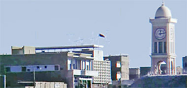
The third photograph looks approximately south-east from the road leading from the roundabout to the Corniche, and shows the Clock Tower on the right with, left centre, Darwish Travel offices and, behind them, the building taken over by, I believe, the Department of Labour and Social Affairs. The flag indicates that it was in use as a government building at the time the photograph was taken.
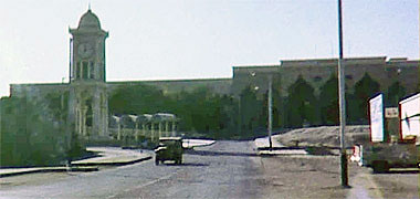
The fourth photograph, taken looking approximately west, shows the main or working entrance to the Diwan al Amiri with the Clock Tower in the centre of its roundabout on the left and, on the right, part of Qatar Cold Stores, the Darwish family’s general purpose food store, and one of the main shops at the beginning of the 1970s, its main rival being the Ali bin Ali Cold Stores adjacent to the residence of Sheikh Suhaim at the north end of Abdullah bin Thani street.

The quality of this photograph is not that good as it was taken from an old Polaroid image made around 1974, perhaps a year later than the photographs above and below, though I can’t be certain of this. The photograph was taken from the parking area in front of the old Darkish Cold Stores, looking south-west towards the Clock Tower with the Grand Mosque behind it. It can be compared with the photograph above which just catches part of the front of the store. The Darwish Travel office is on the left of the photograph and the Diwan Amiri behind the Clock Tower. Parking was a relatively haphazard operation in those days and there was a certain amount of conflict between the cars backing out of the parking area and those cars taking the right turn to join the Corniche, making the visit to the Cold Stores an interesting experience. Having said that, this was a hazardous operation most of the streets in the centre of Doha.

This aerial photograph, looking south-west, was taken of the Diwan al-Amiri development some time in the 1960s and shows that the filling illustrated above had been completed and the beginnings of what was to become the Corniche started. The Clock Tower roundabout has been linked to the Corniche and the Darwish compound can be clearly seen, delineated by a wall. Note that the Darwish ownership extended from what was their Travel Bureau north across the road to the new Corniche, the law allowing ownership to extend a hundred yards from the original foreshore they controlled.

On the left of the photograph above, and on the road leading directly to the eastern entrance of the Diwan al-Amiri can be seen the building which was to be the Doha Municipality building, later the Ministry of Municipal Affairs. Originally, however, I understand that it was the office of Sheikh Khalifa bin Hamad al-Thani when he was Prime Minister, and prior to his moving to Government House as Ruler. Developed on rising ground, the main entrance was at first floor level, the two wings of the building being entered at ground floor level. Although facing north, the arched façade provided a degree of protection to the wings, though was unnecessary on the main façade. The south face of the building was not provided with this system of solar protection.

One of the main characteristics of the new Palace was its concrete construction. Its walls were extremely thick and the internal spans very wide. This would have been a significant novelty when compared with the traditional buildings which generally relied on timber beams, and even the new commercial structures which had much smaller spans than that illustrated here. This photograph, taken in 1962 shows, I believe, the Ruler’s majlis with its chandeliers, wall sconces and table lamps providing light, but ceiling fans creating air movement to cool in summer. The carpet is fitted and the peripheral seating with its associated tables is typical of majaalis arrangement.

Rooms within the Diwan al-Amiri changed their use from time to time as the building developed as a working office for the then Ruler, Sheikh Ahmed bin Ali al-Thani and, later, with his successor, Sheikh Khalifa bin Hamad al-Thani. In this photograph, taken in 1966, the Ruler has entered the majlis with his entourage and is about to hold one of his daily meetings with those looking for assistance or just paying their respects.

In this photograph, also taken in 1966, the Ruler, Sheikh Ahmed bin Ali al-Thani is entering, I believe, the southern of the two courtyards around which the Diwan al-Amiri was constructed, on his way to the majlis. The wide peripheral verandah which was a feature of the east side of both courtyards is clearly seen, as is the structural columns, arranged in threes that carried the ogee arches supporting a similar verandah arrangement on the first floor. Later, the first floor verandah was glazed to enable air-conditioning to be effective.

To the west of the suq and its new jetty was constructed another place to berth local craft. Known as the Ruler’s jetty, it was built opposite the new Diwan al Amiri, a development originally made for the Ruler and his family, though not completed nor used as such. For quite a time the jetty was utilised by the police as a base for their marine activities. This photo of it was taken from the tower of the Grand Mosque, under construction in 1962, and shows at the bottom of the photograph, a part of the roundabout below the mosque incorporating the Clock Tower. Parking is set out for the Diwan al Amiri whose front porch can just be seen to the left of the photograph. It is notable that the ground between the sea and Diwan al Amiri is not finished and I would be interested to learn what was intended as it would have been difficult to soft landscape it. It is likely that a hard landscaping solution would have been sought, with trees in small planters to break up the paving. The Diwan al Amiri was originally built for the ruler, Sheikh Ahmad bin Ali, but not completed before the accession of his successor, Sheikh Khalifa bin Hamad in February 1972.


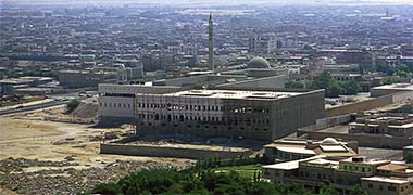
Taken from the north-east, this aerial photograph shows the main entrance to the Diwan al-Amiri and, taken in 1972, possibly pre-dates the photograph above it from casual inspection of the works north of the Diwan entrance. This was the beginning of the programme to provide a parking area for those working in the Diwan. Although the building was developed on a commanding, prominent position, additional fill had to be brought to the site in order to provide a large enough platform for the car park.
The second photograph, taken in March 1972, shows the north face of the Diwan taken from the Corniche which was under construction but not finished when the photo was taken. The fill to the parking area can be glimpsed to the left of the photograph and temporary works belonging to the Engineering Services Department of the Ministry of Public Works, who carried out the work, are in the centre of the photograph.
The third, aerial, photograph, was taken in October 1972 and shows the Diwan al-Amiri from the north-west. I believe that the part of the development which is farthest north – prominent in the centre of the photograph – was originally intended as residential accommodation, but was never completed nor occupied. From its plan it appeared to have been designed as two mirrored units.


In these two photographs you see a view of the residential development, looking north-west over the top of the Diwan al-Amiri, viewed from the top of the burj of the Grand Mosque. Taken in February 1974, the photographs show that work is progressing in the two courtyards of the residential area and, in the lower photograph, gives a good view of the arcading with its ogee arches that characterises the Diwan al-Amiri complex. Beyond the development the Corniche can be seen to have been basically completed with the roads in use. The area to the left of the Corniche is the old housing of al-Bida, the original village on this part of the coast, with some two-storey residential units constructed on the filled area between it and the Corniche, soon to be demolished. The television station can be seen as the white building on the skyline left of centre on the lower photograph.
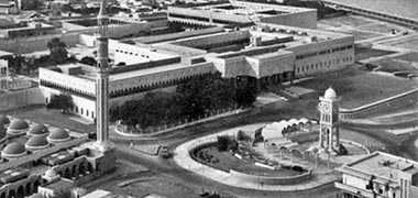

The first of these two photographs is likely to have been taken in the mid 1970s and shows that the area for parking cars in front of the Diwan al-Amiri has been improved and was more or less complete at that time. The second photograph was taken in March, 1976 and gives a better idea of the development of the reorganised car parking area and a staircase from it descending to the lower level opposite the Ruler’s jetty, flanked by two semi-circular retaining walls, their design apparently based on the half-moon battery of Edinburgh Castle. At the foot of the staircase is the beginnings of a landscaped area which was mainly there for aesthetic viewing rather than real use due to the requirements of security. The office of the Ruler occupied the corner of the Diwan above it.

This next pair of aerial photographs were taken a couple of months later than those above, in August 1976. In the first there appears to be a road access from the Corniche to a car park which leads to the upper level car park from which there is a feed out onto the road linking the Corniche with the Clock Tower. It appears to have been used, though I have no recollection of it. Work is being carried out to the south of the Clock Tower roundabout, The two storey Darwish offices which housed their travel bureau can be seen bottom right of the photograph and Darwish’s Qatar Cold Stores can be seen as the single storey development on the right of the photograph. It is evident that there are still storage huts on the Darwish site.

This oblique view of the north façade of the Diwan al-Amiri gives a much better view of the half-moon battery staircase with its access feed from the Corniche. Darwish Travel offices can be seen above them, and the residential wing of the Diwan al-Amiri can be seen to be unfinished and unoccupied to the right. Above the Diwan, the beginnings of six-storey developments, nearly all of them mixed offices and residential, can be seen springing up within the urban fabric of Doha.

This photograph again shows the Grand Mosque with its green domes and the minaret from which the photograph above was taken. This view of it was taken looking at it from the west with the south wall of the Diwan al Amiri to the left. The Rayyan Road runs on the right, parallel to the wall on the left but not shown on this photograph and separated from the Diwan al Amiri wall by a small fenced garden area. This area provided some visual relief to the area but was generally closed and treated as a security area to the Diwan despite this photograph showing a pedestrian walking through it.

The Clock Tower was and, despite the considerable new development, is still a very distinctive feature of Doha. Constructed on a small promontory in 1956 it, together with the old Diwan al Amiri and Grand Mosque, formed an important focus for what were some of the first new developments constructed with the proceeds of the increasing oil revenue. The main masjid and Diwan al Amiri represented the secular and religious faces of the new Doha. This photograph of it shows it under construction but before the surrounding vaulted canopy was built, the pair of structures forming on plan, a representation of a star – the Clock Tower – and crescent moon – the vaulted canopy, one corner of which can be glimpsed in the photo of the entrance to the Diwan al Amiri and its car park above. With the construction of the first road along the north face of the suq, a number of merchants constructed the first modern offices in Doha, the Darwish family having an office immediately adjacent to the Clock Tower and on its south-east corner. This area has now been cleared but, at that time, it represented the strong link there was between the merchant and ruling families.
The road at the top of the photograph above, that shows the Ruler’s jetty, was constructed along the shoreline and led west past feriq al Bida and feriq al Rumaillah to the new hospital and fort which were located at Rumaillah. It also ran past the wadi sail to the road which now leads to the north of the country where Umm Salal Muhammad, the fishing towns of Khor and Ruweis were located as well as Zubara, the town where the al Thani – the ruling family – originally settled in the eighteenth century, and which was recorded as long ago as the first century. It should be noted that the history of Qatar can be taken back as long ago as the fourth millennium BC. A fort was built outside Zubara in 1938 as a Police post and is now a museum similar to the al-kuwt in the centre of Doha. Incidentally, the original road to al Khor followed the coastline, not the line it now takes further inland.
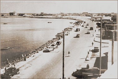
Here is a photo of the road in front of the Ministry of Education. It is likely to be contemporaneous with the 1957 photographs further up the page. The ministry was constructed as a two storey building immediately to the east of the centre of the suq with the Court of Justice between them. The road linked the Ruler’s jetty and the road to the north with feriq al Salata – straight ahead in this photograph. The interest here is in the road itself and its relationship with the water. Vehicles are parked next to the sea and people were able to move to and from the shelter and operation of the suq to the water’s edge.

The development of Umm Salal Muhammad can be compared with that at Khor, a much larger town and one based on pearling and fishing. The khor was a protected inlet of the Persian/Arabian Gulf and, on its sloping shores, the houses developed leaving room only for the fishing boats to be beached and nets spread out. The old town was demolished wholesale in the early seventies with the inhabitants being given ‘Public Houses’, a standard three-bedroomed house sitting centrally located in its enclosing, thirty-metre square surrounding wall. These houses were established on the periphery of the existing town and no plan was made for littoral part of the town when relocating the houses. This photograph, looking east, was taken in March 1972.
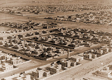
Here you can see a photograph of Medinat Khalifa, the new town which was developed two kilometres west of the existing edge of Doha. The housing was as described above and the character of the layout can be plainly seen. I have to say that, while there has been criticism of these layouts, to a large extent it was those who lived in the old housing who pressed for these new developments as they wanted to take advantage of the government’s generosity to obtain both land and a house. Of course they were not responsible for the form of the development which was considered, by its designer, to represent a rational form of housing. I have written more about this on the al-Salata page.
The Guest Palace

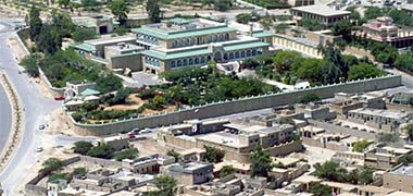
As was mentioned previously, Darwish Engineering were not only responsible for the construction of the Clock Tower adjacent to the Diwan al-Amiri, but also for the ‘Marmar’ or Guest Palace. Shown in this aerial photograph, it was constructed in the early 1950s at Rumailla a mile to the west of the Diwan al-Amiri, though this first government photograph, looking approximately north-east, was taken twenty years later and is included in order to demonstrate the scale of the building and complex for those days compared with the residential developments to its west and, particularly its north. The second aerial photograph, taken in 1976, looks at the complex from the north-east and shows the secured service access on the east wall.
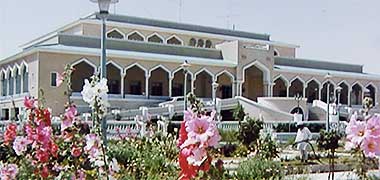
This third image precedes the aerial photographs above in having been taken in 1966 and shows the north facing side of the building within its security wall and across part of its surrounding garden. It was taken from approximately the same angle as the aerial photograph immediately above and illustrates something of the character of the garden landscaping.

This image is unusual in having been taken from the first floor balcony of the Guest Palace in the 1960s. The character and decorative construction of the surrounding wall can be clearly seen. The photograph is also important in showing something of this part of Rumaillah looking just west of north with the fort showing on the skyline. The garden can be seen in its original form planted with flowers, these later taken over with trees, as shown two images above. Surrounding housing was of different types, much of it lived in my government employees, some associated with the fort. The masjid on the left is distinguished by a relatively slim and tall burj and low qubba over the musalla or central prayer space.
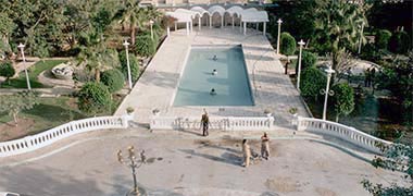
This next image was made in 1980 during a period of extensive renovations being carried out within and around the building complex. The image was taken looking down directly north over the gardens and decorative pool towards the focus designed to replicate the character, if not the detail of the surrounding element of the Clock Tower – though with seven barrel vaults compared with the fourteen of the Clock Tower.
The Guest Palace has a relatively simple internal layout and is surrounded by a wide verandah to provide protection in winter and summer from the elements. The design was novel for the time, its façade having a hint of the Indian sub-continent about it. Note in the photograph below the use of mushrabiyaat to give the south façade a degree of solar protection. Also note the use of pastel colours, particularly blue and pink on the building, with the roof being covered with green tiling and pink tiling paving the forecourt.

This black and white image was taken in the 1960s and looks south-west down from the first floor of the Guest Palace towards the closed entrance gate with its solid teak doors. The small circular entrance garden of the forecourt has been recently planted with roses, I understand because their scent would greet the guests as they arrived. Over the wall is the road through Rumaillah leading right, north-west, to the fort and, directly opposite can be seen the two storeys of the State hospital. Out of sight, south-east across the road, was the Political Agency which became the British Embassy.

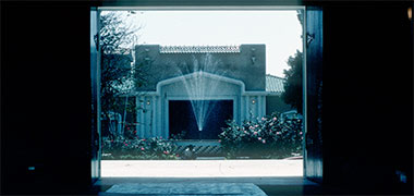
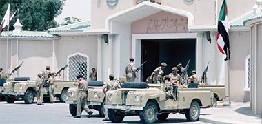
Entrance to the Guest Palace, within its security wall, was gained over a gentle ramp, illustrated here in 1979. The forecourt and other areas of the Palace were covered in pink concrete tiles with kerb edges painted a contrasting pale blue. Balustrades here were kept low and there was a generous staircase connecting the entrance to the building. The entrance area was landscaped simply with trees and flowers, the design incorporating a central feature water fountain, shown in the photograph immediately below.
This view, taken in March 1980 and looking due south, shows the heavy timber entrance gates set within the guardhouse to the Guest Palace when seen from the entrance to the main building. On official visits, the guests’ cars would stand within the courtyard, the main, official car sometimes remaining at the entrance shown here, but more usually would be moved to a shaded part of the front garden. The main gates of the guardhouse would only be opened when necessary for entrance and egress. Security vehicles generally remained on the outside of the security wall as is illustrated by the lower photograph, taken in 1972.


These next group of photographs of the front of the Guest Palace were taken in March and August 1972, and focus on the entrance doors with their adjacent security control. The style of the entrance building echoes the architectural styling of the Guest Palace, the roof of the structure, together with the walls being capped with green glazed roof tiles. The face of the structure has two roundels on it each incorporating religious calligraphy and, over the doors is the customary bismillah, or religious exhortation, customarily introducing any endeavour.
Contrasting with the relative simplicity of the entrance façade and its surrounding walls, the heavy brass boss at the centre of the teak double doors is an intricate foliate design with no calligraphy or geometric design other than that the outer frame of the boss is octagonal, while the internal decorative arrangement is based on four-point geometry. The two, circular brass knockers give some relief to the design, but have little practical value.
There is also the national flag prominently displayed over the centre of the building, fluorescent tubes creating the design in red and white by night, as well as spelling out below it the religious exhortation in green. In addition to this there were a number of coloured tungsten lights strung along the structure and surrounding walls. Not only were tungsten light bulbs deployed to create interest, but this under-exposed view of the Guest Palace at night gives an indication of how fluorescent lighting was introduced to buildings of importance in the early days of national development.


The interiors of the Guest Palace would have been considered modern at the time of its construction, but both spatially and in its detailing, the building did not present itself as well as might be anticipated for its intended purpose. This photograph, taken in June 1980, shows a part of the majlis, the large space in which the visiting guests would receive their guests, including their hosts, in a formal setting.
The space, in its area and volume, was designed to create an imposing setting for important meetings. As can be seen in these two photographs, it may have been a little dated for its time, perhaps having a resemblance to elements of Western pre- and post-war theatres in its ceiling and, particularly lighting designs which were of glass and crystal in scale with the spaces they lit.
Due to the size of the marble floors, specially commissioned carpets were placed in the centre of the majlis covering approximately half its area. In corridors and in some of the other spaces, smaller versions of the main carpets were commissioned as well as being mixed with woven rugs as can be seen in this photograph of a corridor illustrating alternating circular and rectangular woven rugs.

Extensive use of marble was made in both the floors and walls of the building, which is likely to be the reason it came to be referred to in English by some as the ‘Marmar palace’. There was little painting deployed in the main rooms; walls in these areas were generally covered with decorative flock wallpapers as well as silk applied directly to the surface, some of the patterns depicting birds and flowers, unusual in a country that eschewed figurative designs.
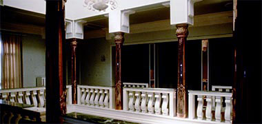

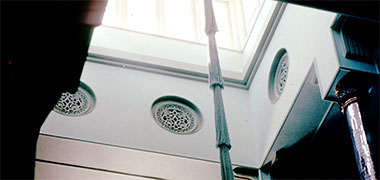
In accordance with protocol, guests to the country were given the building for the length of their stay, and this became their official residence where they might entertain their hosts and guests of their choosing.
It should be noted that although this development responded to a perceived need in a country now reaching out further afield than the Gulf and neighbouring countries, the construction of a single palace for guests would create difficulties in the future when a number of guests of similar status visited the country at the same time. For that reason a group of four guest villas – sometimes known as the VIP villas – were erected in 1976 to serve this purpose.
In this sense the Guest Palace might be considered to be the equivalent of a large scale hotel suite where everything was provided for the guest that might reasonably be expected. The guest would treat the palace as his or her own, and would be able to invite their host or other guests to the palace as they wished – the respective protocol offices sorting out any operational or organisation difficulties.
For instance, although there was a small serving kitchen situated with the grounds of the palace, at least the main meals were generally brought in having been ordered and cooked elsewhere. After its opening, this service was provided by the Sheraton hotel in the New District of Doha.
In the centre of the building there was a relatively small atrium, illustrated in the three photographs above. Concrete columns were encased with bronze mirror-work and the balustrade was of pre-cast concrete, the building structure being concrete as was much of the construction at that time.

I have no recollection of the purpose of the decorative panels, but they may have been intended for the distribution of air-conditioning. It is interesting that, at first glance, they pay lip service to the traditional naqsh plasterwork of the peninsula, yet the patterning is completely different as can be seen in this detail of one of the panels. On the level above there were also fretted panels, though these were circular but with similar foliate patterning.

The bronzed capitals were also unrelated to any of the traditional patterns found in the peninsula, the design being similar to the panels but with a shape reminiscent of the lotus or thistle, forming the base for concrete downstands from the supporting beams above, themselves having a curious addition visually suggesting strapped supports for the column to beam junction.

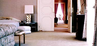

In 1980 the Guest Palace was refurbished with the particular intent to give it a more international or modern look. Where possible, a number of artefacts and design references from around the peninsula were to be introduced as, at that time, it was considered important to produce settings in which guests would feel comfortable while introducing touches of national interest. Generally this was interpreted as using geometric shapes and patterns. Note in this first photograph, the use of a painting with a figurative subject.
Also displayed on the wall is a decorative camel bag with, below it, a traditional chest, decorated with brass studs and commonly referred to in the Gulf as a ‘Kuwaiti’ chest, though used by sailors from the Gulf to the Indian sub-continent in the east and the African coast in the west for storage at sea.
The third of these three interior photographs is the corner of the room viewed through the open door of the second photograph, and shows a traditional hawdaj cane frame surrounded by heavily embroidered, hard cushions, similar to masaanid traditionally used to lean on or against.
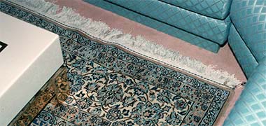
The colour palette employed throughout the refurbishment was of beige carpets throughout with pastel pinks and blues and with contrasting accents and tones as can be seen in the lower of the three photographs above. This photograph shows the corner of a sitting room with a Na’in carpet in its predominately blue and beige sitting on a fitted beige carpet. The patterning on the chairs was deliberately simple and reflected the basic geometries used in traditional building in the peninsula, particularly in respect to the naqsh plasterwork and badu runners and camel accoutrement.
The White Palace

This aerial photograph, thought to be from 1956, shows the location of the building known as the White Palace, situated bottom left of the photograph, and looks almost due east towards the urban development of Doha. The Rayyan Road leads up and east from the bottom of the photograph towards Doha. Later development towards the end of the 1960s or 1970 linked south with the ‘C’ ring road.
The White Palace, which had been in disrepair, was restored around 1971 for an international conference. Previously it is believed that the British Political Agent lived in the White Palace. Following this, the Advisory Council took over the building for many years, but it was eventually demolished between March and September 2013 as Hamad hospital was developed and expanded over this area north of the Rayyan Road.
The oil industry
Prior to the First World War, British interests in the Gulf were mainly concerned with the safety of shipping, this being controlled to some extent by treaties between the British and what were then known as the Trucial States. But by the end of the nineteenth century and immediately prior to the First World War the Ottomans were tenuously established in Qatar though were effectively dislodged by the end of the war. Heavily dependent on the pearl industry in the 1930s, the local economy was undermined by the Japanese development of their artificial pearl industry.
In 1932 oil was discovered in Bahrain. A concession to explore in Qatar was granted in 1935 and, in 1937 the Iraq Petroleum Company Limited, under its operating company Petroleum Developments (Qatar) Limited, successfully located oil on-shore north of Dukhan on the west of the peninsula. Production was ceased during the Second World War but, following resumption in late 1947, the first shipment of Qatar crude oil was made from the deep water port of Umm Said on the east of the country, a pipeline having been constructed across the peninsula for this purpose. The above map, taken from a 1976 Shell company diary, illustrates both the on-shore and off-shore fields at that time.


This first photograph, taken in 1949, shows people working on establishing the first jetty at Umm Said. The development of a deep water port at Umm Said was necessary as it was impossible to bring tankers in to the shallow waters of the west side of the peninsula where oil had been previously discovered around Dukhan. Umm Said sits just north of the sand dunes that link through to Saudi Arabia and become, eventually, the Empty Quarter, but was identified as suitable for developing a port for ocean-going tankers, particularly with selective dredging. The photograph has a tanker of around 10,000 tons deadweight sitting in the roads outside the port and awaiting the loading of crude oil as can be seen by its riding high out of the water. The second photograph was also taken in Umm Said, this time in 1956, and shows the development of a pipeline along the shore there. Note that it is significantly larger than those pipelines in the photographs above and below it.
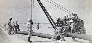
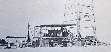
Contemporary with the first photograph is this of a pipeline being laid across the peninsula from Dukhan where the oil was being pumped out of the ground. The pipes are relatively small which suggests they may be feeders to the main cross-country pipeline, but the landscape is flat and more in keeping with the centre of the pensinsula whereas the land around Dukhan where the feeders were situated, is more heavily modelled.
The fourth of these five oil industry related photographs was taken in 1948 and shows one of the first drilling operations in the desert. The photograph illustrates the beginning of the industry that drives Qatar’s economy. Note the scale of the rig and equipment from the size of the crew on the left.

The nascent oil industry was considered a hardship posting for those who were sent to Qatar in order to establish the systematic abstraction of oil. The peninsula was bleak in those days and there was little support for the workers, everything having to be imported with some difficulty. Here, at Bi’r Zikrit on the west coast above Dukhan, goods were craned onto a lorry standing on the simple jetty there with, in this case, a local audience in attendance in 1948.
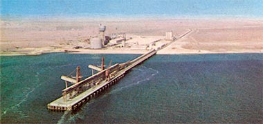
These two aerial photographs, respectively looking approximately west-south-west and south-west, were taken, I believe, in the early and late 1970s. They illustrate the fertiliser plant that was established at Umm Said by Qafco following the formation of the joint venture between Qatar and foreign investors in 1969 with the stated aim of producing fertiliser for both local and international markets.
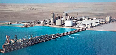
The photographs were taken from two official Government publications. That above shows the fertiliser plant with a single storage tank; this shows it with another tank added. These, and other similar photographs, were taken to illustrate the progress Qatar was making in developing the peninsula, and were published in a number of forms including posters and postcards as well as in books distributed by the Ministry of Information.
South of Qafco’s site was the area from which oil was pumped to ocean going tankers standing out in deep water through their connection via single buoy moorings, SBMs. As you can see from the two photographs, there was little in the area even though there had been activity there for fifteen years or so. The mid-1970s saw the town being developed to the north-west with the first government apartments being constructed there, a similar design to those constructed for Intermediate Staff in the New District of Doha. In the background of the lower photograph some of the smaller sand dunes can be seen which stretched past Umm Said and Khor al-Udaid to the south, to coalesce as part of the Empty Quarter of Saudi Arabia.

To round out these few photographs of the beginnings of the oil industry I’ve added two more photograph, the first of a pipeline in the desert and gas being flared off near Dukhan on the west of the peninsula as it was a feature of the desert since the middle of the last century when oil was discovered under Qatar. For those travelling round the desert this was a relatively common feature of the west side of the peninsula. The pipelines were used by badu to guide and pen their animals, as well as to cross and move along them on the tracks created by the security organisations to guard them.

Here, the road from Umm Bab on the west side of the peninsula has pipelines adjacent to it, one of the ways to police and maintain the lines carrying the vital oil across the peninsula to Umm Said. Note that the pipeline is not straight but zig-zags in order to accommodate expansion and contraction. This character of road was typical of many of the minor roads in the north and west of the peninsula right into the nineteen-seventies. In fact, some of these roads were just oiled tracks, the oil bringing a degree of cohesion to the surface and character of the track. Like old Roman roads, they tended to be set in straight lines from one small hill to another, a potentially dangerous but natural practice as the bends come at points where drivers will be unsighted either because of a change in direction or, as in the lower photograph, an unsighted dip in the road.
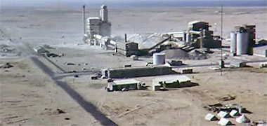
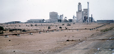
Twenty-five kilometres north of Umm Bab, Dukhan was the centre for that element of the oil and gas industry that was developed on the west side of the peninsula, oil having been discovered there in 1939 and gas some time later. But at Umm Bab, a cement plant was established in order to provide the cement foreseen to be necessary in the development related to the physical infrastructure of the country.
Qatar National Cement Company was established in 1965 by Amiri Decree. The plant was constructed and commercial production of cement begun in May 1969 with a capability of 100,000 tons per annum. These two photographs were taken respectively a year prior to, and three years after, production began. Note in the first photograph that some of the staff were accommodated under canvas.

Finally, here is a photograph that is not all that old and might be thought to be better located in another part of these notes. The early work of oil exploration required considerable movement around the peninsula of those engaged in this activity. A number of vehicles were introduced enabling engineers to move themselves as well as smaller items of equipment from place to place. There was also a need to cross the peninsula between the oil exploration on the west of the peninsula and the areas of Umm Said where oil was pumped onto ocean-going tankers, and Doha where the political and mercantile operations were located. This customised Chevrolet was photographed in the Qatar National Museum in January 1978. Another photograph of saloon cars can be seen on one of the urban design pages.
Early air facilities

The development of the oil industry in Qatar was dependent upon access in what was then a remote part of the world. With the oil industry developing on both sides of the Qatar peninsula, at Dukhan and Umm Said, both needed an airport facility. Umm Said had a deep water marine approach, but access to Dukhan was far more problematic with initial access in the 1930s and 1940s by the relatively shallow sea to a jetty at Zekrit.
In the photograph above, a Blackburn Universal is seeing taxiing before take-off on a short flight to Fahud, Oman, where a less sophisticated airport than that at Umm Said existed.
The airport at Umm Said was located between the camp and the oil storage tanks and operated in the 1950s and 1960s until around 1968 when the State’s International airport was opened to the east of Doha. As can be seen above, the facilities in Umm Said consisted of a basic structure housing the State’s requirements for recording passenger movements together with a simple control tower to control and monitor the aircraft.

I am unsure as to when the airport at Dukhan was established, but it is likely to have been in the very late 1940s or early 1950s as work on developing the oil industry intensified. The runway was oriented on an approximate west north-west, east south-east axis and was located around five kilometres inland from the east littoral and two kilometres south of the road between Dukhan and al-Rayyan.

Compared with the later development of airport facilities at Umm Said, the control tower constructed for Dukhan was a more solid structure, similar in many respects to the utilitarian structures placed around the peninsula for security installations. Some of those were constructed with the then increasingly common concrete block but others, like this, were built from the traditional limestone blocks. It is difficult to discern from the photograph, but the observation platform appears to have been built with a metal or timber frame. This image – for which regrettably I have not been able to ask permission to use due to its site having disappeared – shows how the structure appeared in the Spring of 2008. I don’t know if there was a separate building for incoming and outgoing passengers and baggage.
As was mentioned on a related page the British Royal Air Force had an interest in the the Qatar peninsula prior to the outbreak of the Second World War, particularly with a view to safeguarding flights to India, and most probably between Bahrein and Sharjah.
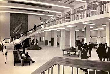
Some time in the 1960s, the increasing demand for access to the developments in Qatar saw the construction of Doha’s International Airport. Located some way to the east of the centre of Doha it was an important step in opening the peninsula to the rest of the world. There is a little more on its facilities on another page, but here is an image of the departure lounge which was still in operation into the 1970s. The photograph shows stairs to the upper level where there were offices for the airport’s staff as well as, top right, access to the enclosed and open viewing areas.

In those days, access between the aircraft and airport building was made at grade on foot. Family and friends leaving and arriving could be seen from the viewing areas which were a very popular facililty in the cooler hours and, particularly, at night. The second photograph, taken in 1975 from the open viewing platform, shows a Gulf Air VC10 standing on the apron with passenger luggage being loaded into the rear of the aircraft. The two mobile stairs were manually rolled into place allowing passengers to board and leave the aircraft. Eventually it was felt that the viewing facilities were too popular and over-crowded so, sadly, were closed to all.
More to be written…
Note
While there are a number of photographs on this page that were taken in the 1960s, there are more on one of the Gulf architecture pages.
Search the Islamic design study pages
- Introduction
- Arabic / Islamic design
- Arabic / Islamic geometry 01
- Arabic / Islamic geometry 02
- Arabic / Islamic geometry 03
- Arabic / Islamic geometry 04
- Islamic architecture
- Islamic urban design 01
- Islamic urban design 02
- Islamic urban design 03
- Islamic urban design 04
- Islamic urban design 05
- Arabic / Islamic gardens
- Gulf architecture 01
- Gulf architecture 02
- Gulf architecture 03
- Gulf architecture 04
- Gulf architecture 05
- Gulf architecture 06
- Gulf architecture 07
- Gulf architecture 08
- Infrastructure development
- The building industry
- Environmental control
- Perception
- The household on its lot
- A new approach – conceptual
- A new approach – principles
- A new approach – details
- al-Salata al jadida
- Public housing
- Expatriate housing study
- Apartment housing
- Pressures for change
- The State’s administration
- Society 01
- Society 02
- Society 03
- Society 04
- Society 05
- Society 06
- History of the peninsula
- Geography
- Planning 01
- Planning 02
- Population
- Traditional boats
- Boat types
- Old Qatar 01
- Old Qatar 02
- Security
- Protection
- Design brief
- Design elements
- Building regulations
- Glossary
- Glossary addendum
- References
- References addendum
- Links to other sites